Area Overview for AL3 6BG
Photos of AL3 6BG
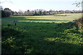
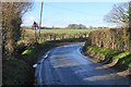
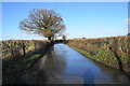
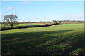
20 photos from this area
Area Information
Key information about the AL3 6BG including its size, population, and administrative classification.
- Area Type
- Postcode
- Area Size
- 2.1 hectares
- Population
- 2059
- Population Density
- 1701 people/km²
House Prices in AL3 6BG
28
Properties
£925,315
Average Sold Price
£495,000
Lowest Price
£1,915,000
Highest Price
Showing 28 properties
| Address | Type | Beds | Baths | Last Sale Price | Last Sale Date | |
|---|---|---|---|---|---|---|
| 13 Ellis Fields, St Albans, AL3 6BG | Semi-detached | 7 | 4 | £1,375,000 | Jun 2025 | |
| 41 Ellis Fields, St Albans, AL3 6BG | Detached | 5 | 3 | £1,475,000 | Sep 2023 | |
| 27 Ellis Fields, St Albans, AL3 6BG | Detached | 4 | 2 | £965,000 | Jan 2023 | |
| 11A Ellis Fields, St Albans, AL3 6BG | house | 5 | 4 | £1,915,000 | Nov 2022 | |
| 37 Ellis Fields, St Albans, AL3 6BG | house | - | - | £1,050,000 | Nov 2020 | |
| 21 Ellis Fields, St Albans, AL3 6BG | house | - | - | £940,000 | Oct 2020 | |
| 17 Ellis Fields, St Albans, AL3 6BG | Terraced | 4 | 3 | £857,500 | Sep 2019 | |
| 23 Ellis Fields, St Albans, AL3 6BG | Semi-detached | 4 | 3 | £1,272,500 | Sep 2018 | |
| 33 Ellis Fields, St Albans, AL3 6BG | Detached | 4 | 2 | £920,000 | Oct 2015 | |
| 47 Ellis Fields, St Albans, AL3 6BG | house | 5 | - | £970,000 | Oct 2013 |
Page 1 of 3
Energy Efficiency in AL3 6BG
Amenities
Schools
| Rank | School | Type | Entry gender | Ages |
|---|
Explore more schools in this area
Go to Schools tabDemographics
Household Size
Family (3-5 people)
most common
Accommodation Type
Houses
most common
Tenure
67
majority
Ethnic Group
White
most common
Religion
N/A
most common
Household Composition
N/A
most common
Age
47
median
Adults (30-64 years)
most common
Household Deprivation
N/A
with no deprivation
NS-SEC
49
in Lower managerial occupations
Explore more demographic insights in this area
Go to Demographics tabPlanning
Planning Constraints
- Flood RiskPremium
- Ramsar Wetland SitesPremium
- Area of Outstanding Natural BeautyPremium
- Protected Nature ReservePremium
- Protected WoodlandPremium