Area Overview for AL3 5QG
Photos of AL3 5QG
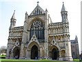
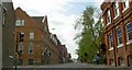
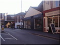
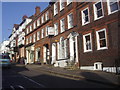
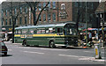
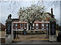
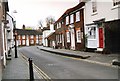
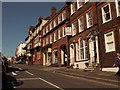

100 photos from this area
Area Information
Key information about the AL3 5QG including its size, population, and administrative classification.
- Area Type
- Postcode
- Area Size
- 5432 m²
- Population
- 2210
- Population Density
- 6400 people/km²
House Prices in AL3 5QG
17
Properties
£439,200
Average Sold Price
£208,000
Lowest Price
£675,000
Highest Price
Showing 17 properties
| Address | Type | Beds | Baths | Last Sale Price | Last Sale Date | |
|---|---|---|---|---|---|---|
| Bleak House Mews, 6 Normandy Road, St Albans, AL3 5QG | Terraced | 2 | 1 | £550,000 | Feb 2025 | |
| 19 Normandy Road, St Albans, AL3 5QG | Terraced | 3 | 1 | £675,000 | Jun 2024 | |
| Bleak House Mews, 8 Normandy Road, St Albans, AL3 5QG | Terraced | 2 | 2 | £465,000 | Jan 2021 | |
| 25 Normandy Road, St Albans, AL3 5QG | house | 2 | 1 | £475,000 | May 2020 | |
| 13 Normandy Road, St Albans, AL3 5QG | Semi-detached | 3 | 2 | £630,001 | Jun 2016 | |
| 23 Normandy Road, St Albans, AL3 5QG | Detached | 2 | 1 | £415,000 | Mar 2016 | |
| Normandy Cottage, 25A Normandy Road, St Albans, AL3 5QG | Terraced | 3 | 2 | £389,000 | Jun 2013 | |
| 3 Normandy Road, St Albans, AL3 5QG | house | - | - | £350,000 | Aug 2009 | |
| 17 Normandy Road, St Albans, AL3 5QG | Terraced | - | - | £208,000 | Oct 2000 | |
| 5 Normandy Road, St Albans, AL3 5QG | Terraced | - | - | £235,000 | Dec 1997 |
Page 1 of 2
Energy Efficiency in AL3 5QG
Amenities
Schools
| Rank | School | Type | Entry gender | Ages |
|---|
Explore more schools in this area
Go to Schools tabDemographics
Household Size
Family (3-5 people)
most common
Accommodation Type
Houses
most common
Tenure
65
majority
Ethnic Group
White
most common
Religion
N/A
most common
Household Composition
N/A
most common
Age
47
median
Adults (30-64 years)
most common
Household Deprivation
N/A
with no deprivation
NS-SEC
63
in Lower managerial occupations
Explore more demographic insights in this area
Go to Demographics tabPlanning
Planning Constraints
- Flood RiskPremium
- Ramsar Wetland SitesPremium
- Area of Outstanding Natural BeautyPremium
- Protected Nature ReservePremium
- Protected WoodlandPremium