Area Overview for AL3 5NH
Photos of AL3 5NH
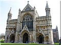
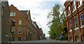
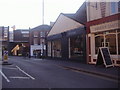
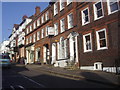

100 photos from this area
Area Information
Key information about the AL3 5NH including its size, population, and administrative classification.
- Area Type
- Postcode
- Area Size
- 2192 m²
- Population
- 2103
- Population Density
- 5464 people/km²
House Prices in AL3 5NH
9
Properties
£539,944
Average Sold Price
£250,000
Lowest Price
£886,500
Highest Price
Showing 9 properties
| Address | Type | Beds | Baths | Last Sale Price | Last Sale Date | |
|---|---|---|---|---|---|---|
| 34 Goldsmith Way, St Albans, AL3 5NH | Detached | 3 | 3 | £886,500 | Mar 2025 | |
| 46 Goldsmith Way, St Albans, AL3 5NH | Flat | - | - | £520,000 | Oct 2024 | |
| 42 Goldsmith Way, St Albans, AL3 5NH | house | 4 | 3 | £755,000 | Dec 2020 | |
| 48 Goldsmith Way, St Albans, AL3 5NH | Flat | - | - | £427,000 | Jan 2019 | |
| 32 Goldsmith Way, St Albans, AL3 5NH | house | - | - | £603,000 | Nov 2014 | |
| 40 Goldsmith Way, St Albans, AL3 5NH | house | - | - | £585,000 | Nov 2013 | |
| 38 Goldsmith Way, St Albans, AL3 5NH | house | 3 | - | £553,000 | Jul 2013 | |
| 44 Goldsmith Way, St Albans, AL3 5NH | Flat | - | - | £280,000 | Jul 2005 | |
| 36 Goldsmith Way, St Albans, AL3 5NH | house | - | - | £250,000 | Aug 1999 |
Energy Efficiency in AL3 5NH
Amenities
Schools
| Rank | School | Type | Entry gender | Ages |
|---|
Explore more schools in this area
Go to Schools tabDemographics
Household Size
Family (3-5 people)
most common
Accommodation Type
Houses
most common
Tenure
73
majority
Ethnic Group
White
most common
Religion
N/A
most common
Household Composition
N/A
most common
Age
47
median
Adults (30-64 years)
most common
Household Deprivation
N/A
with no deprivation
NS-SEC
61
in Lower managerial occupations
Explore more demographic insights in this area
Go to Demographics tabPlanning
Planning Constraints
- Flood RiskPremium
- Ramsar Wetland SitesPremium
- Area of Outstanding Natural BeautyPremium
- Protected Nature ReservePremium
- Protected WoodlandPremium