Area Overview for AL3 4HQ
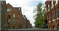
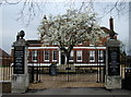
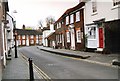
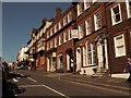
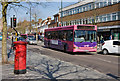
Photos of AL3 4HQ


Area Information
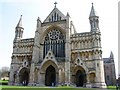
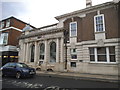
Living in AL3 4HQ means being part of a small, tightly knit residential cluster within the historic city of St Albans. With a population of 2,017 and a density of 1,657 people per square kilometre, this area reflects a compact, well-established community. Its location at the northwestern edge of St Albans ties it to the ancient Roman town of Verulamium, adding layers of historical significance to everyday life. The area’s proximity to St Albans Abbey and its surrounding infrastructure ensures easy access to cultural, educational, and commercial hubs. Daily life here balances suburban tranquillity with urban convenience, with residents benefiting from nearby rail links and a mix of retail options. The median age of 47 and a population skewed toward adults aged 30–64 suggest a mature, stable demographic, often drawn to the area’s blend of historical charm and practical living. For those seeking a place with roots in Roman history yet modern amenities, AL3 4HQ offers a distinctive blend of past and present.
- Area Type
- Postcode
- Area Size
- Not available
- Population
- 2017
- Population Density
- 1657 people/km²
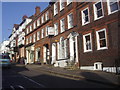
The property market in AL3 4HQ is dominated by owner-occupied homes, with 72% of properties in private hands. This high ownership rate suggests a stable, long-term resident base rather than a rental-focused market. The accommodation type is primarily houses, which contrasts with areas where flats or apartments predominate. This housing stock appeals to families and individuals seeking traditional, spacious living arrangements. The small size of the area means that property availability is limited, and buyers should consider the immediate surrounding areas for more options. The density of 1,657 people per square kilometre indicates a compact, well-utilised space, but the focus on houses suggests that new developments are likely to prioritise single-family homes over high-density housing. For buyers, this means a market where properties are likely to be in demand, with a strong emphasis on established, well-maintained homes.
House Prices in AL3 4HQ
No properties found in this postcode.
Energy Efficiency in AL3 4HQ
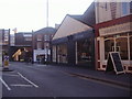
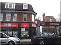
The lifestyle in AL3 4HQ is enriched by its proximity to essential amenities. Within practical reach are five retail venues, including Co-op St, M&S St, and M&S St Albans BP, offering everyday shopping and fueling needs. The rail network, with five stations nearby, ensures convenient travel for commuting or leisure. While the data does not specify parks or leisure facilities, the area’s historical context suggests nearby green spaces, such as Verulamium Park, which may be accessible for recreation. The presence of retail and transport hubs adds to the area’s convenience, allowing residents to meet daily needs without long journeys. This blend of practical amenities and historical surroundings creates a lifestyle that balances modern convenience with a touch of heritage, making it appealing for those seeking both functionality and character.
Amenities
Schools
Residents of AL3 4HQ have access to a range of educational institutions, including The Abbey Church of England Voluntary Aided Primary School, which holds a good Ofsted rating. This state-funded primary school offers a reliable option for families seeking a local, affordable education. Nearby independent schools include St Columba’s College, St Columba’s Preparatory School, and St Albans School, catering to those seeking private education. The mix of school types provides flexibility, allowing families to choose between state and independent options based on their priorities. The presence of both sectors ensures a competitive educational landscape, though the independent schools may have higher fees and selective admissions. For parents, this diversity means access to a variety of curricula and extracurricular opportunities, though the proximity of these schools to AL3 4HQ varies, requiring consideration of commuting times.
| Rank | School | Type | Entry gender | Ages |
|---|
Explore more schools in this area
Go to Schools tabDemographics
The community in AL3 4HQ is predominantly composed of adults aged 30–64, with a median age of 47. This reflects a mature, settled population, many of whom are likely to be homeowners, given that 72% of homes are owner-occupied. The area is characterised by houses rather than flats, indicating a preference for traditional family homes. The predominant ethnic group is White, which aligns with broader trends in the region. The high proportion of home ownership and the age profile suggest a community focused on long-term stability rather than transient rental living. While the data does not specify deprivation levels, the combination of age, ownership rates, and housing types implies a generally secure socioeconomic environment. This demographic profile shapes a neighbourhood where established families and professionals coexist, with limited turnover and a strong sense of local identity.
Household Size
Accommodation Type
Tenure
Ethnic Group
Religion
Household Composition
Age
Household Deprivation
NS-SEC
Explore more demographic insights in this area
Go to Demographics tabPlanning
Planning Constraints
- Flood RiskPremium
- Ramsar Wetland SitesPremium
- Area of Outstanding Natural BeautyPremium
- Protected Nature ReservePremium
- Protected WoodlandPremium