Area Overview for AL3 4EE
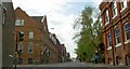
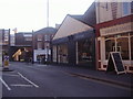
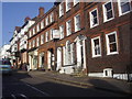
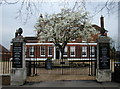
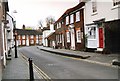
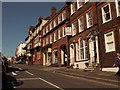
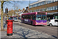
Photos of AL3 4EE


Area Information
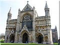
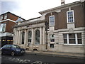
Living in AL3 4EE means being part of a tightly knit residential cluster within the historic city of St Albans, Hertfordshire. This postcode area, part of Verulam Ward, sits at the northwestern edge of the city, near the remnants of the ancient Roman town of Verulamium. With a population of 2017 people and a density of 1657 people per square kilometre, it is a compact, well-defined community. The area’s character is shaped by its proximity to St Albans, offering easy access to the city’s cultural and commercial hubs while retaining a suburban feel. Historic sites like Verulam House, a Grade II listed building, and nearby Roman walls add a layer of heritage to daily life. Residents benefit from strong transport links, including multiple railway stations within walking distance, and a mix of retail and services nearby. The area’s blend of historical significance, practical amenities, and proximity to a thriving city makes it appealing to those seeking a balance between tradition and modern convenience.
- Area Type
- Postcode
- Area Size
- Not available
- Population
- 2017
- Population Density
- 1657 people/km²
The property market in AL3 4EE is characterised by a high rate of home ownership (72%) and a predominance of houses. This suggests a community where property is largely owner-occupied, with fewer rental properties available. The focus on houses rather than flats or apartments indicates a market catering to families or individuals seeking more space and privacy. Given the area’s small size and high population density, the housing stock is likely to be tightly packed, with limited scope for expansion. Buyers should consider that the market may be less dynamic compared to larger urban areas, with property values potentially influenced by the area’s historical and geographical attributes. The proximity to St Albans and its amenities could enhance property appeal, though the limited size of AL3 4EE means that immediate surroundings are critical for assessing investment potential.
House Prices in AL3 4EE
No properties found in this postcode.
Energy Efficiency in AL3 4EE
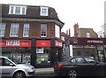
Residents of AL3 4EE enjoy a range of amenities within easy reach, including five retail outlets such as Co-op St, M&S St, and Tesco St. These shops provide convenience for everyday shopping, from groceries to household essentials. The area’s proximity to St Albans also opens up access to larger retail centres, dining options, and cultural attractions. Parks and open spaces, such as Verulamium Park, offer opportunities for recreation and relaxation, with historical sites like the Roman walls adding to the area’s charm. The presence of multiple railway stations ensures easy access to city and regional amenities, while the compact nature of AL3 4EE fosters a sense of community. The blend of practical retail, transport links, and historical landmarks contributes to a lifestyle that balances convenience with a touch of heritage.
Amenities
Schools
Residents of AL3 4EE have access to a range of educational institutions, including The Abbey Church of England Voluntary Aided Primary School, which holds an Ofsted rating of ‘good’. This state-funded primary school provides a solid foundation for younger children. For independent education, St Columba’s College, St Columba’s Preparatory School, and St Albans School are nearby, offering private schooling options. The mix of state and independent schools gives families flexibility in choosing education paths, whether prioritising affordability or specialised curricula. The presence of multiple schools within practical reach ensures that children have access to both local and high-quality educational environments. However, the specific performance metrics of the independent schools are not detailed in the data, so prospective families may need to conduct further research into their reputations and admissions policies.
| Rank | School | Type | Entry gender | Ages |
|---|
Explore more schools in this area
Go to Schools tabDemographics
The community in AL3 4EE is predominantly composed of adults aged 30–64, with a median age of 47. This suggests a mature, stable population, likely with established careers and families. Home ownership is high at 72%, indicating a strong preference for long-term residency over renting. The accommodation type is primarily houses, reflecting a residential area with larger properties rather than flats or apartments. The predominant ethnic group is White, though specific data on diversity or deprivation is not provided. The age profile implies a community focused on family life and stability, with fewer young dependents or retirees compared to other areas. This demographic structure may influence local services and amenities, which are tailored to the needs of middle-aged households. The absence of detailed diversity metrics means the area’s social fabric remains largely unexplored in public data.
Household Size
Accommodation Type
Tenure
Ethnic Group
Religion
Household Composition
Age
Household Deprivation
NS-SEC
Explore more demographic insights in this area
Go to Demographics tabPlanning
Planning Constraints
- Flood RiskPremium
- Ramsar Wetland SitesPremium
- Area of Outstanding Natural BeautyPremium
- Protected Nature ReservePremium
- Protected WoodlandPremium