Area Overview for AL3 4DR
Photos of AL3 4DR


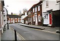
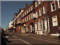


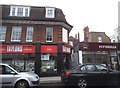
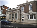
100 photos from this area
Area Information
Key information about the AL3 4DR including its size, population, and administrative classification.
- Area Type
- Postcode
- Area Size
- 4770 m²
- Population
- 1800
- Population Density
- 2731 people/km²
House Prices in AL3 4DR
8
Properties
£1,080,000
Average Sold Price
£550,000
Lowest Price
£1,610,000
Highest Price
Showing 8 properties
| Address | Type | Beds | Baths | Last Sale Price | Last Sale Date | |
|---|---|---|---|---|---|---|
| 185 Verulam Road, St Albans, AL3 4DR | Semi-detached | 4 | 3 | £1,610,000 | Jun 2025 | |
| 183 Verulam Road, St Albans, AL3 4DR | Terraced | - | - | £550,000 | Mar 2006 | |
| The White Mill, 181 Verulam Road, St Albans, AL3 4DR | Terraced | 5 | 2 | - | - | |
| Flat 2, Kingsbury Lodge, 1 Branch Road, St Albans, AL3 4DR | Flat | - | - | - | - | |
| Flat 3, Kingsbury Lodge, 1 Branch Road, St Albans, AL3 4DR | Flat | - | - | - | - | |
| Store At Unit 3, 181A Verulam Road, St Albans, AL3 4DR | warehouse | - | - | - | - | |
| Fontayne Signs And Displays Litd, Workshop At Unit 3, 181A Verulam Road, St Albans, AL3 4DR | office_workshop | - | - | - | - | |
| Tom Tom Audio Ltd, Victoria House, 181 Verulam Road, St Albans, AL3 4DR | Office | - | - | - | - |
Energy Efficiency in AL3 4DR
Amenities
Schools
| Rank | School | Type | Entry gender | Ages |
|---|
Explore more schools in this area
Go to Schools tabDemographics
Household Size
Two person
most common
Accommodation Type
Houses
most common
Tenure
73
majority
Ethnic Group
White
most common
Religion
N/A
most common
Household Composition
N/A
most common
Age
47
median
Adults (30-64 years)
most common
Household Deprivation
N/A
with no deprivation
NS-SEC
65
in Lower managerial occupations
Explore more demographic insights in this area
Go to Demographics tabPlanning
Planning Constraints
- Flood RiskPremium
- Ramsar Wetland SitesPremium
- Area of Outstanding Natural BeautyPremium
- Protected Nature ReservePremium
- Protected WoodlandPremium