Area Overview for AL2 3RY
Photos of AL2 3RY
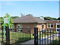
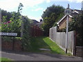
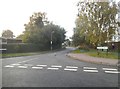

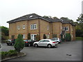
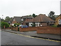
11 photos from this area
Area Information
Key information about the AL2 3RY including its size, population, and administrative classification.
- Area Type
- Postcode
- Area Size
- 5469 m²
- Population
- 1614
- Population Density
- 223 people/km²
House Prices in AL2 3RY
10
Properties
£407,531
Average Sold Price
£148,000
Lowest Price
£637,250
Highest Price
Showing 10 properties
| Address | Type | Beds | Baths | Last Sale Price | Last Sale Date | |
|---|---|---|---|---|---|---|
| 44 Jenkins Avenue, Bricket Wood, AL2 3RY | Bungalow | 3 | 1 | £637,250 | Oct 2021 | |
| 46 Jenkins Avenue, Bricket Wood, AL2 3RY | Bungalow | - | - | £467,500 | Jul 2015 | |
| 58 Jenkins Avenue, Bricket Wood, AL2 3RY | Bungalow | 4 | - | £610,000 | Jul 2015 | |
| 48 Jenkins Avenue, Bricket Wood, AL2 3RY | Bungalow | 3 | 2 | £480,000 | Aug 2014 | |
| 52 Jenkins Avenue, Bricket Wood, AL2 3RY | Detached | 4 | 2 | £455,000 | Mar 2014 | |
| 50 Jenkins Avenue, Bricket Wood, AL2 3RY | Detached | - | - | £305,000 | Nov 2001 | |
| 42 Jenkins Avenue, Bricket Wood, AL2 3RY | Semi-detached | 3 | 1 | £157,500 | Nov 1999 | |
| 40 Jenkins Avenue, Bricket Wood, AL2 3RY | Semi-detached | - | - | £148,000 | Jul 1997 | |
| 54 Jenkins Avenue, Bricket Wood, AL2 3RY | Bungalow | 3 | 1 | - | - | |
| 56 Jenkins Avenue, Bricket Wood, AL2 3RY | Detached | - | - | - | - |
Energy Efficiency in AL2 3RY
Amenities
Schools
| Rank | School | Type | Entry gender | Ages |
|---|
Explore more schools in this area
Go to Schools tabDemographics
Household Size
Two person
most common
Accommodation Type
Houses
most common
Tenure
85
majority
Ethnic Group
White
most common
Religion
N/A
most common
Household Composition
N/A
most common
Age
47
median
Adults (30-64 years)
most common
Household Deprivation
N/A
with no deprivation
NS-SEC
40
in Lower managerial occupations
Explore more demographic insights in this area
Go to Demographics tabPlanning
Planning Constraints
- Flood RiskPremium
- Ramsar Wetland SitesPremium
- Area of Outstanding Natural BeautyPremium
- Protected Nature ReservePremium
- Protected WoodlandPremium