Area Overview for AL2 2WG
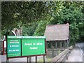
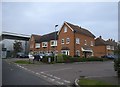
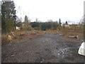
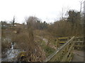
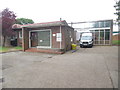
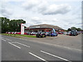
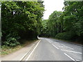
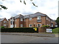
Photos of AL2 2WG


Area Information
Living in AL2 2WG means being part of a small, tightly knit residential cluster in Hertfordshire, near St Albans. With a population of 2,054 and a density of 372 people per square kilometre, this area balances compact living with a sense of community. Its historical roots are evident in the nearby Church of St Stephen, founded in the 10th century, and the remnants of medieval infrastructure, such as the former Parish House at Park Street. The area’s proximity to St Albans offers easy access to larger towns, while its quieter streets suggest a slower pace of life. Daily routines here are shaped by local amenities, including nearby rail stations and schools, and a mix of residential housing that reflects a long-standing tradition of homeownership. AL2 2WG is not a sprawling suburb but a focused, manageable community where neighbours are likely to know one another. Its small size means it’s ideal for those seeking a peaceful, low-density environment without sacrificing connectivity to urban centres.
- Area Type
- Postcode
- Area Size
- Not available
- Population
- 2054
- Population Density
- 372 people/km²
AL2 2WG is primarily an owner-occupied area, with 61% of homes owned by residents rather than rented. The accommodation type is predominantly houses, which aligns with the area’s low population density and traditional residential character. This suggests a market where family homes and long-term investments dominate, rather than a rental-heavy environment. Given the small size of the postcode area, the housing stock is limited, which may mean competition for properties is higher than in larger regions. Buyers should consider the proximity to local amenities, such as schools and transport links, as key factors in the area’s appeal. The focus on houses rather than flats may also cater to those prioritising space and private outdoor areas. However, the lack of detailed data on property prices or recent market trends means potential buyers must conduct further research into individual listings.
House Prices in AL2 2WG
No properties found in this postcode.
Energy Efficiency in AL2 2WG
The lifestyle in AL2 2WG is shaped by its proximity to retail and transport hubs. Nearby amenities include Co-op St, M&S St Albans Mount BP, and Co-op Watford, offering everyday shopping needs. The five rail stations within practical reach provide access to broader leisure and employment opportunities, while the area’s small size ensures a compact, walkable environment. Though specific parks or leisure facilities are not detailed in the data, the presence of historic sites like the Church of St Stephen adds cultural value. Residents benefit from a balance between local convenience and regional connectivity, allowing them to enjoy both quiet domestic life and access to urban amenities. The mix of retail and transport options supports a practical lifestyle, though further exploration of nearby green spaces or recreational facilities would be necessary for a fuller picture.
Amenities
Schools
Residents of AL2 2WG have access to a range of school options, including Park Street Church of England Voluntary Aided Primary School, which holds a good Ofsted rating. This primary school serves younger children, while Radlett Lodge School and Harperbury Hospital School are special schools, both with good Ofsted ratings. The Edward Jenner Hospital School is also nearby but lacks an Ofsted rating in the data. The mix of school types means families can choose between mainstream education and specialist provisions, though the absence of a rating for one school may require further investigation. For parents seeking a broad educational spectrum, the area offers both general and niche options. However, the limited number of schools suggests that proximity to other educational institutions outside the postcode may be necessary for secondary education.
| Rank | School | Type | Entry gender | Ages |
|---|
Explore more schools in this area
Go to Schools tabDemographics
The community in AL2 2WG is predominantly composed of adults aged 30–64, with a median age of 47. This suggests a mature population, likely with established careers and families. Home ownership is strong, with 61% of residents owning their homes, a figure that indicates stability and long-term residency. The area is characterised by houses rather than flats, reflecting a preference for single-family dwellings. The predominant ethnic group is White, though specific data on diversity is not provided. The age profile and homeownership rate suggest a community focused on settled living rather than transient populations. For quality of life, this demographic structure may mean fewer pressures from student or young professional populations, though it also implies limited generational turnover. The absence of detailed diversity statistics means broader cultural or social dynamics remain unexplored in the data.
Household Size
Accommodation Type
Tenure
Ethnic Group
Religion
Household Composition
Age
Household Deprivation
NS-SEC
Explore more demographic insights in this area
Go to Demographics tabPlanning
Planning Constraints
- Flood RiskPremium
- Ramsar Wetland SitesPremium
- Area of Outstanding Natural BeautyPremium
- Protected Nature ReservePremium
- Protected WoodlandPremium