Area Overview for AL2 2QT
Photos of AL2 2QT
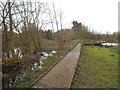
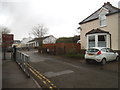
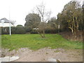
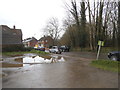
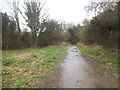
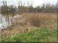
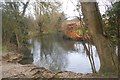
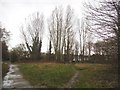
47 photos from this area
Area Information
Key information about the AL2 2QT including its size, population, and administrative classification.
- Area Type
- Postcode
- Area Size
- 6516 m²
- Population
- 1768
- Population Density
- 735 people/km²
House Prices in AL2 2QT
9
Properties
£702,850
Average Sold Price
£249,950
Lowest Price
£1,250,000
Highest Price
Showing 9 properties
| Address | Type | Beds | Baths | Last Sale Price | Last Sale Date | |
|---|---|---|---|---|---|---|
| 29 Penn Road, Park Street, St Albans, AL2 2QT | Detached | 4 | 2 | £820,000 | Nov 2023 | |
| 27 Penn Road, Park Street, St Albans, AL2 2QT | Detached | 5 | - | £1,250,000 | May 2014 | |
| 19 Penn Road, Park Street, St Albans, AL2 2QT | house | - | - | £540,000 | Jun 2013 | |
| 25 Penn Road, Park Street, St Albans, AL2 2QT | Detached | 6 | 5 | £780,000 | Sep 2012 | |
| 23 Penn Road, Park Street, St Albans, AL2 2QT | Detached | - | - | £615,000 | Jan 2008 | |
| 17 Penn Road, Park Street, St Albans, AL2 2QT | Detached | 5 | - | £665,000 | Jun 2007 | |
| 21 Penn Road, Park Street, St Albans, AL2 2QT | Bungalow | 4 | 4 | £249,950 | Sep 1998 | |
| Penhill House, 17A Penn Road, Park Street, St Albans, AL2 2QT | Detached | 3 | 1 | - | - | |
| 17B Penn Road, Park Street, St Albans, AL2 2QT | Detached | 5 | - | - | - |
Energy Efficiency in AL2 2QT
Amenities
Schools
| Rank | School | Type | Entry gender | Ages |
|---|
Explore more schools in this area
Go to Schools tabDemographics
Household Size
Family (3-5 people)
most common
Accommodation Type
Houses
most common
Tenure
90
majority
Ethnic Group
White
most common
Religion
N/A
most common
Household Composition
N/A
most common
Age
47
median
Adults (30-64 years)
most common
Household Deprivation
N/A
with no deprivation
NS-SEC
48
in Lower managerial occupations
Explore more demographic insights in this area
Go to Demographics tabPlanning
Planning Constraints
- Flood RiskPremium
- Ramsar Wetland SitesPremium
- Area of Outstanding Natural BeautyPremium
- Protected Nature ReservePremium
- Protected WoodlandPremium