Area Overview for AL2 2ER
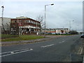
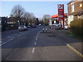
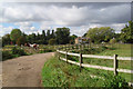
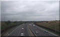
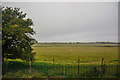
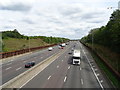
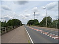
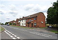
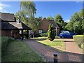
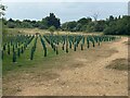
Photos of AL2 2ER


Area Information
Living in AL2 2ER means being part of a small, tightly knit residential cluster in Hertfordshire, near St Albans. With a population of 2,054 and a density of 372 people per square kilometre, this area balances quiet suburban life with proximity to larger towns. Historically rooted, the parish of St. Stephen dates back to the 10th century, with a medieval church and 18th-century workhouse shaping its character. Today, it offers a mix of traditional housing and modern amenities. Residents benefit from nearby rail links to Radlett and Bricket Wood, while local shops and schools provide daily convenience. The area’s compact size fosters a sense of community, though its small footprint means many residents look to surrounding towns for broader services. AL2 2ER is ideal for those seeking a peaceful yet connected lifestyle, with easy access to regional transport networks and a rich historical backdrop.
- Area Type
- Postcode
- Area Size
- Not available
- Population
- 2054
- Population Density
- 372 people/km²
AL2 2ER is primarily an owner-occupied area, with 61% of homes owned by residents rather than rented. The housing stock consists mostly of houses, which is typical for small, residential postcode areas. This suggests a market skewed towards family buyers seeking traditional homes rather than rental investors. The limited population of 2,054 means the local property supply is constrained, potentially pushing buyers to consider nearby towns like Radlett or St Albans for more options. The dominance of owner-occupied properties indicates a community prioritising long-term investment, though the small area size may mean limited scope for development or new builds. For those considering purchase, the focus on houses aligns with a preference for private, spacious living rather than high-density housing.
House Prices in AL2 2ER
No properties found in this postcode.
Energy Efficiency in AL2 2ER
AL2 2ER’s lifestyle is defined by its proximity to essential amenities and transport hubs. Local shops like Tesco Radlett and Co-op St cater to daily needs, while nearby railway stations provide swift access to Radlett, St Albans, and beyond. The area’s compact size means residents can walk or cycle to key services, fostering a sense of convenience. Though parks and leisure facilities are not explicitly listed in the data, the presence of multiple railway stations suggests access to green spaces in surrounding areas. The blend of retail, transport, and connectivity supports a practical, community-focused lifestyle, ideal for those valuing accessibility without sacrificing suburban tranquillity.
Amenities
Schools
AL2 2ER is served by a range of schools, including Park Street Church of England Voluntary Aided Primary School, which holds a ‘good’ Ofsted rating. For special educational needs, Radlett Lodge School and The Edward Jenner Hospital School both have ‘good’ ratings, while Harperbury Hospital School also caters to specialist requirements. This mix of primary and special schools ensures families have options for both general and tailored education. The presence of multiple institutions suggests a commitment to supporting diverse educational needs within the community. However, the absence of secondary schools in the immediate area may require students to commute to nearby towns. For parents, the quality ratings indicate reliable standards, though proximity to higher education facilities remains a consideration.
| Rank | School | Type | Entry gender | Ages |
|---|
Explore more schools in this area
Go to Schools tabDemographics
AL2 2ER’s population is predominantly middle-aged, with a median age of 47 and the majority of residents falling within the 30–64 age range. This suggests a community focused on family life and stability. Home ownership is strong, with 61% of properties occupied by their owners, indicating a preference for long-term residency. The area is characterised by houses rather than flats, reflecting a traditional, low-density housing stock. The predominant ethnic group is White, though no specific data on diversity or deprivation is provided. The age profile and ownership rates imply a mature, established community with limited turnover. For buyers, this stability may mean fewer short-term renters and a more predictable property market, though the small population size could limit local social networks.
Household Size
Accommodation Type
Tenure
Ethnic Group
Religion
Household Composition
Age
Household Deprivation
NS-SEC
Explore more demographic insights in this area
Go to Demographics tabPlanning
Planning Constraints
- Flood RiskPremium
- Ramsar Wetland SitesPremium
- Area of Outstanding Natural BeautyPremium
- Protected Nature ReservePremium
- Protected WoodlandPremium