Area Overview for AL2 2DJ
Photos of AL2 2DJ
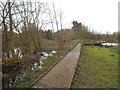
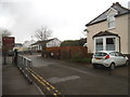
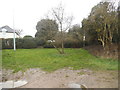
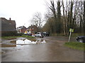
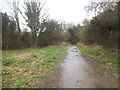
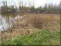
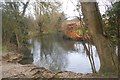
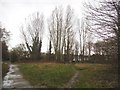
47 photos from this area
Area Information
Key information about the AL2 2DJ including its size, population, and administrative classification.
- Area Type
- Postcode
- Area Size
- 8211 m²
- Population
- 1393
- Population Density
- 1294 people/km²
House Prices in AL2 2DJ
11
Properties
£572,900
Average Sold Price
£245,000
Lowest Price
£980,000
Highest Price
Showing 11 properties
| Address | Type | Beds | Baths | Last Sale Price | Last Sale Date | |
|---|---|---|---|---|---|---|
| 9 Slowmans Close, Park Street, St Albans, AL2 2DJ | Detached | 5 | 3 | £980,000 | Dec 2024 | |
| 8 Slowmans Close, Park Street, St Albans, AL2 2DJ | Detached | 4 | - | £775,000 | Aug 2017 | |
| 11 Slowmans Close, Park Street, St Albans, AL2 2DJ | Detached | 4 | 2 | £660,000 | Nov 2016 | |
| 6 Slowmans Close, Park Street, St Albans, AL2 2DJ | Detached | 4 | 3 | £819,000 | Aug 2016 | |
| 2 Slowmans Close, Park Street, St Albans, AL2 2DJ | Detached | - | - | £680,000 | Jul 2008 | |
| 10 Slowmans Close, Park Street, St Albans, AL2 2DJ | Semi-detached | 5 | 2 | £500,000 | Jul 2007 | |
| 1 Slowmans Close, Park Street, St Albans, AL2 2DJ | Detached | - | - | £245,000 | Apr 1998 | |
| 5 Slowmans Close, Park Street, St Albans, AL2 2DJ | Detached | - | - | £350,000 | Mar 1998 | |
| 3 Slowmans Close, Park Street, St Albans, AL2 2DJ | Detached | - | - | £365,000 | Mar 1998 | |
| 4 Slowmans Close, Park Street, St Albans, AL2 2DJ | Detached | - | - | £355,000 | Dec 1997 |
Page 1 of 2
Energy Efficiency in AL2 2DJ
Amenities
Schools
| Rank | School | Type | Entry gender | Ages |
|---|
Explore more schools in this area
Go to Schools tabDemographics
Household Size
Family (3-5 people)
most common
Accommodation Type
Houses
most common
Tenure
91
majority
Ethnic Group
White
most common
Religion
N/A
most common
Household Composition
N/A
most common
Age
47
median
Adults (30-64 years)
most common
Household Deprivation
N/A
with no deprivation
NS-SEC
45
in Lower managerial occupations
Explore more demographic insights in this area
Go to Demographics tabPlanning
Planning Constraints
- Flood RiskPremium
- Ramsar Wetland SitesPremium
- Area of Outstanding Natural BeautyPremium
- Protected Nature ReservePremium
- Protected WoodlandPremium