Area Overview for AL2 1UJ
Photos of AL2 1UJ

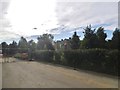
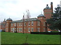
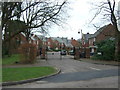
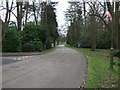
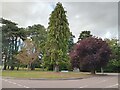
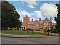
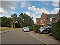
15 photos from this area
Area Information
Key information about the AL2 1UJ including its size, population, and administrative classification.
- Area Type
- Postcode
- Area Size
- 19.8 hectares
- Population
- 1690
- Population Density
- 941 people/km²
House Prices in AL2 1UJ
19
Properties
£723,763
Average Sold Price
£469,995
Lowest Price
£1,120,000
Highest Price
Showing 19 properties
| Address | Type | Beds | Baths | Last Sale Price | Last Sale Date | |
|---|---|---|---|---|---|---|
| 2 Beningfield Drive, London Colney, AL2 1UJ | Detached | 5 | 3 | £1,120,000 | Jan 2025 | |
| 4 Beningfield Drive, London Colney, AL2 1UJ | house | - | - | £1,082,000 | Nov 2023 | |
| 1 Beningfield Drive, London Colney, AL2 1UJ | house | - | - | £822,000 | Dec 2021 | |
| 9 Beningfield Drive, London Colney, AL2 1UJ | Detached | 5 | 3 | £900,000 | Sep 2018 | |
| 3 Beningfield Drive, London Colney, AL2 1UJ | Detached | 4 | 3 | £900,000 | Sep 2018 | |
| 17 Beningfield Drive, London Colney, AL2 1UJ | house | 4 | - | £745,000 | May 2017 | |
| 18 Beningfield Drive, London Colney, AL2 1UJ | Detached | 4 | 2 | £667,500 | Jan 2016 | |
| 12 Beningfield Drive, London Colney, AL2 1UJ | Detached | 4 | 3 | £790,000 | Oct 2014 | |
| The Rowans, 13 Beningfield Drive, London Colney, AL2 1UJ | house | - | - | £525,000 | Apr 2013 | |
| 8 Beningfield Drive, London Colney, AL2 1UJ | house | - | - | £680,000 | Nov 2011 |
Page 1 of 2
Energy Efficiency in AL2 1UJ
Amenities
Schools
| Rank | School | Type | Entry gender | Ages |
|---|
Explore more schools in this area
Go to Schools tabDemographics
Household Size
Family (3-5 people)
most common
Accommodation Type
Houses
most common
Tenure
72
majority
Ethnic Group
White
most common
Religion
N/A
most common
Household Composition
N/A
most common
Age
47
median
Adults (30-64 years)
most common
Household Deprivation
N/A
with no deprivation
NS-SEC
44
in Lower managerial occupations
Explore more demographic insights in this area
Go to Demographics tabPlanning
Planning Constraints
- Flood RiskPremium
- Ramsar Wetland SitesPremium
- Area of Outstanding Natural BeautyPremium
- Protected Nature ReservePremium
- Protected WoodlandPremium