Area Overview for AL2 1SF

Lake at Broad Colney Lakes in AL2 1SF
River Colne: Broad Colney Bridge in AL2 1SF
Access road off Shenley Lane in AL2 1SF
St Annes Road, London Colney in AL2 1SF
Shenley Lane, Broad Colney in AL2 1SF
Woods by Shenley Lane, Broad Colney in AL2 1SF
Works access road off Shenley Lane in AL2 1SF
Path through the woods, Broad Colney in AL2 1SF
Redland Gravel, London Colney in AL2 1SF
Houses on Shenley Lane (B5378) in AL2 1SF
Shenley Lane (B5378), London Colney in AL2 1SF
Broad Colney Lakes Nature Reserve in AL2 1SF
33 photos from this area

Area Information

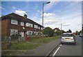
AL2 1SF lies within London Colney, a small residential cluster in St Albans, Hertfordshire. This postcode area is part of the broader AL2 district, which includes nearby towns such as Napsbury, Bricket Wood, and Colney Street. The area is served by the St Albans Royal Mail Delivery Office and is accessible via key roads like the A1081 and A1057, with Junction 22 of the M25 motorway just 10 minutes’ drive away. While AL2 1SF is primarily residential, it also features commercial and industrial zones, including the Riverside Industrial Estate on the London Colney By Pass. Retail options are available at Colney Fields Shopping Park, located in the wider London Colney district. The area blends suburban living with proximity to employment hubs, making it suitable for those seeking a balance between convenience and space. Its location in Hertfordshire places it within reach of London’s transport networks, though it retains a quieter, more localised character. The postcode’s small size means it is ideal for buyers looking for a focused, community-oriented environment with easy access to major roads and nearby amenities.

Area Type
Postcode
Area Size
Not available
Population
1580
Population Density
1640 people/km²

House Prices in AL2 1SF

No properties found in this postcode.

Energy Efficiency in AL2 1SF

Amenities

Schools

Explore more schools in this area

Go to Schools tab

Demographics

Household Size

Family (3-5 people)
most common

Accommodation Type

Houses
most common

Tenure

66
majority

Ethnic Group

White
most common

Religion

N/A
most common

Household Composition

N/A
most common

Age

47
median
Adults (30-64 years)
most common

Household Deprivation

N/A
with no deprivation

NS-SEC

36
in Lower managerial occupations

Explore more demographic insights in this area

Go to Demographics tab

Planning

Planning Constraints

  • Flood Risk
    Premium
  • Ramsar Wetland Sites
    Premium
  • Area of Outstanding Natural Beauty
    Premium
  • Protected Nature Reserve
    Premium
  • Protected Woodland
    Premium
  • Crime Risk
    Premium

Explore more planning insights in this area

Open Planning map

Frequently Asked Questions

What is the community feel like in AL2 1SF?
AL2 1SF is a small, residential postcode within London Colney, part of St Albans. It includes areas like Napsbury and Bricket Wood, with a mix of commercial and industrial facilities. The community is likely tight-knit, with proximity to retail hubs like Colney Fields Shopping Park and easy access to major roads such as the M25. However, specific details on social dynamics or local culture are not provided in the data.
Who typically lives in AL2 1SF?
The area includes residential clusters in London Colney and surrounding districts. While no specific demographic data is available, its proximity to industrial estates and retail parks suggests a mix of local workers and families. The postcode’s small size indicates a focused, community-oriented population without detailed breakdowns of age or household types.
Is AL2 1SF a safe place to live?
Yes, AL2 1SF has a low crime risk with a safety score of 68/100, below the average. It also has no flood risk and no protected natural sites that could pose environmental hazards. These factors contribute to a generally secure living environment for residents.

We use cookies to provide you with the best experience. By continuing, you agree to our Cookie Policy .