Area Overview for AL2 1AF
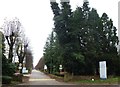
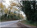
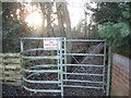
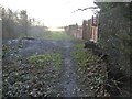
Photos of AL2 1AF


Area Information
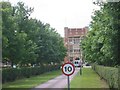
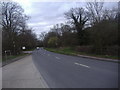
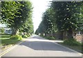
Living in AL2 1AF, a small residential postcode cluster in London Colney, Hertfordshire, offers a blend of suburban tranquillity and strategic connectivity. With a population of 1,580, this area is characterised by its historic roots and modern convenience. Situated near Junction 22 of the M25 motorway, it provides easy access to London and surrounding towns like St Albans, Hatfield, and Luton. The village’s charm lies in its conservation area, centred on the River Colne, where timber-framed buildings from the 16th and 17th centuries remain. Residents benefit from proximity to open spaces, including gravel pits transformed into nature reserves for wildlife and recreation. Daily life here is shaped by a mix of historical heritage and practical amenities, with local shops, rail links, and schools within reach. The area’s compact size fosters a close-knit community, while its location ensures accessibility to larger urban centres for work, shopping, and leisure.
- Area Type
- Postcode
- Area Size
- Not available
- Population
- 1580
- Population Density
- 1640 people/km²
The property market in AL2 1AF is dominated by owner-occupied homes, with 66% of properties owned by residents rather than rented. The accommodation type is primarily houses, which is typical of a suburban area with limited high-density development. This suggests a market focused on family homes and long-term residency rather than short-term rentals or speculative investment. The small size of the postcode area means the housing stock is likely limited, with properties concentrated around the village core and nearby residential clusters. Buyers should consider the area’s proximity to St Albans and the M25, which may influence property values and desirability. The predominance of houses also implies a need for larger gardens or outdoor space, which may appeal to those seeking a traditional suburban lifestyle. However, the limited scale of the area means buyers may need to look beyond AL2 1AF for more extensive property options.
House Prices in AL2 1AF
Showing 3 properties
| Address | Type | Beds | Baths | Last Sale Price | Last Sale Date | |
|---|---|---|---|---|---|---|
| Spec Centre, St Raphaels Centre, Shenley Lane, London Colney, AL2 1AF | Flat | 2 | 1 | - | - | |
| Chantry Lodge, All Saints Pastoral Centre, Shenley Lane, London Colney, AL2 1AF | residential_school | - | - | - | - | |
| St Lukes, All Saints Pastoral Centre, Shenley Lane, London Colney, AL2 1AF | Detached | 3 | 2 | - | - |
Energy Efficiency in AL2 1AF
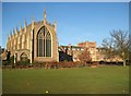
The lifestyle in AL2 1AF is shaped by its mix of historic charm and modern convenience. Nearby amenities include five retail outlets, such as Sainsburys, M&S, and Co-op, ensuring everyday shopping needs are met. The village’s proximity to the River Colne and surrounding nature reserves offers opportunities for outdoor activities, from walking to fishing. The conservation area, centred on the historic High Street and Telford’s Bridge, preserves the village’s heritage while providing a focal point for community life. Residents can enjoy the character of timber-framed buildings and the convenience of nearby rail stations, which connect to St Albans, Hatfield, and Luton. This blend of natural beauty, historical significance, and accessible amenities creates a balanced lifestyle, appealing to those who value both tranquillity and connectivity.
Amenities
Schools
Residents of AL2 1AF have access to three primary schools within practical reach: Bowmansgreen Primary School, Saint Bernadette Catholic Primary School, and Saint Bernadette Voluntary Catholic Primary Academy. Two of these schools have an Ofsted rating of ‘good’, indicating a strong foundation for early education. The presence of multiple primary schools suggests a family-friendly environment, with options for both state and Catholic education. While no secondary schools are listed in the data, the proximity to St Albans—a larger town with comprehensive schooling—may be a consideration for families requiring secondary education. The variety of primary schools allows parents to choose between different educational philosophies, from mainstream state schools to faith-based institutions. This diversity supports the area’s appeal to families seeking reliable, locally accessible education for their children.
| Rank | School | Type | Entry gender | Ages |
|---|
Explore more schools in this area
Go to Schools tabDemographics
AL2 1AF has a median age of 47, with the majority of residents falling within the 30–64 age range. This suggests a mature, stable population, likely drawn to the area’s established character and infrastructure. Home ownership is high at 66%, indicating a strong presence of long-term residents and a market skewed towards owner-occupied properties. The predominant accommodation type is houses, reflecting a suburban rather than high-density living environment. The predominant ethnic group is White, though specific data on diversity or deprivation is not provided. The age profile and ownership rates suggest a community prioritising stability and family-oriented living, with fewer transient residents. This demographic profile aligns with the area’s historic, low-rise housing stock and its appeal to those seeking a quieter, connected lifestyle outside major cities.
Household Size
Accommodation Type
Tenure
Ethnic Group
Religion
Household Composition
Age
Household Deprivation
NS-SEC
Explore more demographic insights in this area
Go to Demographics tabPlanning
Planning Constraints
- Flood RiskPremium
- Ramsar Wetland SitesPremium
- Area of Outstanding Natural BeautyPremium
- Protected Nature ReservePremium
- Protected WoodlandPremium