Area Overview for AL2 1AA
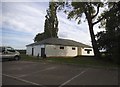
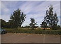
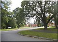
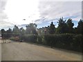
Photos of AL2 1AA


Area Information
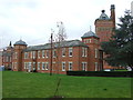
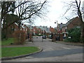
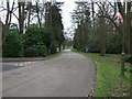
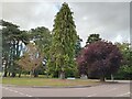
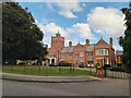
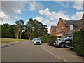
Living in AL2 1AA means inhabiting a small, tightly knit residential cluster in southern Hertfordshire, just north of London. The postcode covers a village with a population of 1,690, spread across 1.77 km², creating a dense yet manageable community. Situated near Junction 22 of the M25 motorway, it serves as a commuter hub for St Albans and surrounding areas. Historically, the village grew around the River Colne, a tributary of the Thames, and retains echoes of its past as a coaching inn stop on Watling Street. Today, AL2 1AA blends suburban convenience with pockets of conservation, including timber-framed buildings from the 16th and 17th centuries. Daily life here is shaped by proximity to St Albans, with bus routes connecting to nearby towns like Hatfield and Luton. Residents benefit from a mix of modern amenities, including retail outlets like Co-op London and Sainsburys, alongside natural spaces such as gravel pits that double as wildlife reserves. The area’s compact size means most needs are met within walking distance, though its small footprint also means housing options are limited to a few hundred properties.
- Area Type
- Postcode
- Area Size
- Not available
- Population
- 1690
- Population Density
- 941 people/km²
AL2 1AA is predominantly an owner-occupied area, with 72% of properties owned by residents rather than rented. The housing stock is largely composed of houses, reflecting the suburban nature of the village and its role as a satellite to St Albans. This contrasts with areas dominated by flats or rental properties, making AL2 1AA more appealing to families or individuals seeking long-term stability. However, the small size of the postcode—covering just 1.77 km²—means the housing market is limited to a few hundred properties. Buyers should consider nearby areas for more options, though the village’s compact layout ensures most amenities are within walking distance. The presence of a conservation area, including historic timber-framed buildings, adds character but may also influence property values and availability.
House Prices in AL2 1AA
No properties found in this postcode.
Energy Efficiency in AL2 1AA
Residents of AL2 1AA enjoy a blend of suburban convenience and natural amenities. The village’s High Street crosses the River Colne at Telford’s Bridge, a Grade II listed structure, and includes historic pubs like the Bull and Green Dragon. Nearby, the River Colne and its associated lakes offer recreational opportunities, including fishing and wildlife observation. Retail options are limited but practical, with Co-op London, Tesco Colney, and Sainsburys within reach. The area’s conservation status preserves its historic character, with timber-framed buildings and sites like Salisbury Hall, a 15th-century manor house. Public transport connects to St Albans and other towns, while the M25 ensures easy access to London. The mix of heritage, green space, and modern amenities creates a lifestyle balanced between tradition and practicality.
Amenities
Schools
| Rank | School | Type | Entry gender | Ages |
|---|
Explore more schools in this area
Go to Schools tabDemographics
AL2 1AA’s population of 1,690 is predominantly composed of adults aged 30–64, with a median age of 47. This suggests a mature, stable community with strong family ties and a focus on long-term residency. Home ownership is high, at 72%, indicating a preference for settled living over rental tenancies. The area is largely composed of houses rather than flats, reflecting a suburban character. Ethnically, the population is predominantly White, though specific diversity metrics are not detailed in the data. The low crime risk score of 76/100, described as “below average,” implies a safe environment for residents. However, the absence of detailed deprivation data means broader socioeconomic factors remain unexplored. The demographic profile aligns with a community prioritising stability, with limited turnover and a focus on established households.
Household Size
Accommodation Type
Tenure
Ethnic Group
Religion
Household Composition
Age
Household Deprivation
NS-SEC
Explore more demographic insights in this area
Go to Demographics tabPlanning
Planning Constraints
- Flood RiskPremium
- Ramsar Wetland SitesPremium
- Area of Outstanding Natural BeautyPremium
- Protected Nature ReservePremium
- Protected WoodlandPremium