Area Overview for AL10 9SL
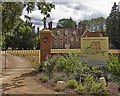
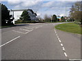
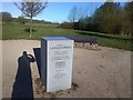
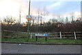
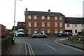
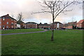
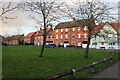
Photos of AL10 9SL

Area Information
Living in AL10 9SL offers a compact, residential experience within a small cluster of homes. With a population of 1,548 spread across 2.0 hectares, this area is characterised by a low density of 122 people per square kilometre, suggesting a quiet, community-focused environment. The median age of 47 indicates a mature demographic, with the majority of residents aged between 30 and 64. This suggests a stable, established community where many homeowners have lived for years. The area’s proximity to Hatfield, a larger town, ensures access to services while retaining a village-like atmosphere. Daily life here is likely to be relaxed, with local amenities and transport links providing convenience without overwhelming the small-scale character of the neighbourhood. The absence of major infrastructure or industrial activity reinforces its appeal as a peaceful, low-maintenance place to live.
- Area Type
- Postcode
- Area Size
- 2.0 hectares
- Population
- 1548
- Population Density
- 122 people/km²
The property market in AL10 9SL is dominated by owner-occupied homes, with 75% of properties owned by residents rather than rented. This high home ownership rate suggests a community with long-term residents and a stable housing stock. The accommodation type is primarily houses, which is unusual for a small area of 2.0 hectares, indicating that properties are likely to be larger or more spread out than in typical urban settings. Buyers considering this area should note that the housing stock is limited in size, meaning opportunities for purchase may be constrained to existing homes rather than new developments. The proximity to Hatfield and nearby rail stations could make this area attractive to those seeking a quieter alternative to larger towns, though the small size of AL10 9SL means the immediate surroundings are key to assessing property options.
House Prices in AL10 9SL
No properties found in this postcode.
Energy Efficiency in AL10 9SL
The lifestyle in AL10 9SL is supported by nearby amenities within practical reach. Retail options include Aldi Hatfield, M&S Hatfield, and Co-op Birchwood, offering everyday shopping convenience. The area’s rail links to Hatfield, Welwyn Garden City, and Welham Green provide easy access to larger towns for additional services, dining, and leisure. While the immediate area is small, the surrounding towns offer a broader range of facilities. The presence of multiple retail outlets and transport connections suggests a balance between local convenience and regional accessibility. This setup is ideal for those who value a quiet, residential environment but still require proximity to urban amenities for work, shopping, or social activities.
Amenities
Schools
The nearest school to AL10 9SL is St John’s Voluntary Aided Church of England Primary School in Lemsford, which serves the local primary education needs. This school is rated as good by Ofsted, offering a reliable option for families with young children. The absence of secondary schools in the immediate area means parents may need to consider commuting to Hatfield or nearby towns for secondary education. The presence of a single primary school suggests a small student population, which could contribute to a close-knit educational community. However, the lack of secondary options highlights a potential limitation for families requiring a full range of schooling within the area.
| Rank | School | Type | Entry gender | Ages |
|---|
Explore more schools in this area
Go to Schools tabDemographics
The community in AL10 9SL is predominantly composed of adults aged 30 to 64, reflecting a mature population with a median age of 47. Home ownership is high, with 75% of residents living in their own homes, suggesting a stable and long-term resident base. The accommodation type is primarily houses, which aligns with the area’s small size and low density. The predominant ethnic group is White, though no specific data on diversity or deprivation is provided. This demographic profile indicates a community focused on family life and long-term residency, with fewer transient populations. The age range suggests a mix of middle-aged professionals and older residents, potentially creating a balanced social dynamic. The lack of rental properties implies a lower turnover rate, contributing to a sense of continuity in the area.
Household Size
Accommodation Type
Tenure
Ethnic Group
Religion
Household Composition
Age
Household Deprivation
NS-SEC
Explore more demographic insights in this area
Go to Demographics tabPlanning
Planning Constraints
- Flood RiskPremium
- Ramsar Wetland SitesPremium
- Area of Outstanding Natural BeautyPremium
- Protected Nature ReservePremium
- Protected WoodlandPremium