Area Overview for AL10 8BW
Photos of AL10 8BW
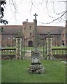
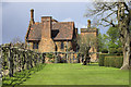
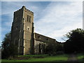
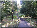

100 photos from this area
Area Information
Key information about the AL10 8BW including its size, population, and administrative classification.
- Area Type
- Postcode
- Area Size
- 1.0 hectares
- Population
- 1787
- Population Density
- 4139 people/km²
House Prices in AL10 8BW
29
Properties
£178,000
Average Sold Price
£70,000
Lowest Price
£310,000
Highest Price
Showing 29 properties
| Address | Type | Beds | Baths | Last Sale Price | Last Sale Date | |
|---|---|---|---|---|---|---|
| 9 Howe Dell, Hatfield, AL10 8BW | house | 1 | 2 | £285,000 | Nov 2024 | |
| 5 Howe Dell, Hatfield, AL10 8BW | Flat | 2 | 1 | £240,000 | Sep 2023 | |
| 11 Howe Dell, Hatfield, AL10 8BW | house | - | - | £310,000 | Feb 2022 | |
| 45 Howe Dell, Hatfield, AL10 8BW | Flat | 1 | - | £135,000 | Aug 2014 | |
| 33 Howe Dell, Hatfield, AL10 8BW | house | - | - | £207,500 | Jun 2014 | |
| 25 Howe Dell, Hatfield, AL10 8BW | Flat | - | - | £125,000 | Dec 2011 | |
| 7 Howe Dell, Hatfield, AL10 8BW | house | 3 | 1 | £157,000 | Oct 2009 | |
| 51 Howe Dell, Hatfield, AL10 8BW | house | 3 | - | £177,500 | Aug 2006 | |
| 49 Howe Dell, Hatfield, AL10 8BW | house | - | - | £70,000 | Oct 1997 | |
| 17 Howe Dell, Hatfield, AL10 8BW | house | - | - | £73,000 | Sep 1997 |
Page 1 of 3
Energy Efficiency in AL10 8BW
Amenities
Schools
| Rank | School | Type | Entry gender | Ages |
|---|
Explore more schools in this area
Go to Schools tabDemographics
Household Size
One person
most common
Accommodation Type
Houses
most common
Tenure
25
majority
Ethnic Group
White
most common
Religion
N/A
most common
Household Composition
N/A
most common
Age
47
median
Adults (30-64 years)
most common
Household Deprivation
N/A
with no deprivation
NS-SEC
21
in Lower managerial occupations
Explore more demographic insights in this area
Go to Demographics tabPlanning
Planning Constraints
- Flood RiskPremium
- Ramsar Wetland SitesPremium
- Area of Outstanding Natural BeautyPremium
- Protected Nature ReservePremium
- Protected WoodlandPremium