Area Overview for AL10 0UL
Photos of AL10 0UL


Area Information
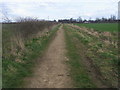
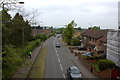
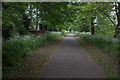
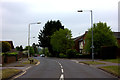
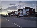
Living in AL10 0UL offers a distinct experience within the Hatfield South parish of Hertfordshire. This specific postcode cluster is compact, covering just 3741 square metres yet home to 1782 residents. The area is defined by its rural character while maintaining access to the practical conveniences of a nearby town. You are part of a small residential cluster where daily life balances quiet neighbourhood streets with the accessibility of regional train stations. The identity of AL10 0UL is tied closely to the Hatfield area, specifically the Hatfield South community. This locality does not claim to be a major urban centre but rather a peaceful stop along the route between London and the north. Residents appreciate the proximity to Hatfield Railway Station without being overwhelmed by urban traffic. The area functions as a supportive residential pocket where community members know their neighbours. You can enjoy the benefits of living near a market town while retaining the pace and scale of a village setting. The compact size of the postcode means walkability remains a feature for many, though vehicle access is often preferred for connecting to wider Hertfordshire.
- Area Type
- Postcode
- Area Size
- 3741 m²
- Population
- 1782
- Population Density
- 5470 people/km²
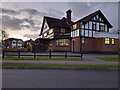
The property market in AL10 0UL is characterised by a strong emphasis on home ownership. With 60% of residents owning their homes, the area is firmly rooted in owner-occupancy rather than being a collection of rental properties. This statistic suggests that most sales in the immediate vicinity come from owners looking to move up, down, or sideways within the market. The dominance of Houses indicates that buyers can expect single-family dwellings rather than flats or apartments. This profile appeals to those seeking a traditional suburban or semi-rural lifestyle. You will find a stock of family homes and possibly some period properties suited to mature buyers. The low density of the postcode area, covering only 3741 m² for over 1700 people, implies a built environment where houses stand on sized plots. While the total area seems small, the housing stock likely extends into the immediate surroundings of Hatfield South. For those considering homes in AL10 0UL, the market offers a chance to join an established cohort of homeowners rather than entering a competitive private rental sector. The accommodation type and ownership levels define a market that values space and permanence.
House Prices in AL10 0UL
Showing 7 properties
| Address | Type | Beds | Baths | Last Sale Price | Last Sale Date | |
|---|---|---|---|---|---|---|
| 1 St Michaels View, Hatfield, AL10 0UL | Bungalow | - | - | - | - | |
| 7 St Michaels View, Hatfield, AL10 0UL | Bungalow | - | - | - | - | |
| 6 St Michaels View, Hatfield, AL10 0UL | Bungalow | - | - | - | - | |
| 5 St Michaels View, Hatfield, AL10 0UL | Bungalow | - | - | - | - | |
| 4 St Michaels View, Hatfield, AL10 0UL | Bungalow | - | - | - | - | |
| 2 St Michaels View, Hatfield, AL10 0UL | Bungalow | - | - | - | - | |
| 3 St Michaels View, Hatfield, AL10 0UL | Bungalow | - | - | - | - |
Energy Efficiency in AL10 0UL
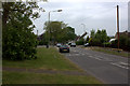
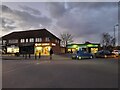
Daily life in AL10 0UL centres on access to the amenities found in the nearby town of Hatfield. Residents have five retail options at their disposal, including Co-op Birchwood, Tesco Hatfield, and Iceland Hatfield. These venues ensure you can shop for groceries and everyday necessities without venturing far. Five rail connections further support your ability to travel easily to wider Hertfordshire and London. The lifestyle here is defined by simplicity and convenience. You can run weekly errands at Tesco Hatfield or grab a bottle of water at Co-op Birchwood. The presence of three notable railway stations means that catching a train is straightforward if you need to travel. This arrangement supports a lifestyle where you stay close to home but do not miss out on the services of a larger town. There is a balance between the peacefulness of a small residential cluster and the utility of being near a major market town. For those who prefer walking to shops or easy access to public transport, the location of Hatfield amenities works in your favour.
Amenities
Schools
Families considering homes in AL10 0UL have several primary options nearby. Gascoyne Cecil Junior School and Salisbury Infants' School serve the local educational needs of the area. These institutions provide primary education though specific Ofsted ratings are not available for these two in the current dataset. You will also find Birchwood Avenue Primary School nearby, which holds a 'good' Ofsted rating. Having a school with this confirmed rating is a significant advantage for parents assessing AL10 0UL for potential settlement. The mix of schools suggests a well-supplied local education cluster. Children in the AL10 0UL postcode will have access to primary education without needing to travel far. The presence of both infant and junior designations indicates a steady progression for young learners living in adjacent parishes. If you are buying for a child, the guaranteed quality rating of Birchwood Avenue Primary School provides a concrete metric for decision-making. For other children, the two un-rated schools offer local alternatives within the Hatfield South community. The school provision is adequate for the population size, ensuring that living in AL10 0UL meets the educational requirements of young families.
| Rank | School | Type | Entry gender | Ages |
|---|
Explore more schools in this area
Go to Schools tabDemographics
The community in AL10 0UL reflects a mature population with a median age of 47 years. Most residents fall into the Adults category, spanning ages 30 to 64. This age profile suggests a neighbourhood populated by established adults rather than young professionals or families with very small children. House ownership is high here, with 60% of residents owning their homes outright or with a mortgage. This indicates a stable community where people have chosen AL10 0UL as their long-term residence. Most accommodation in this cluster consists of Houses, which aligns with the preference of older adults and families seeking space. The predominant ethnic group is White, making the demographic landscape relatively homogenous compared to larger urban centres. This mix creates a quiet, established atmosphere typical of many rural parishes in Hertfordshire. The high rate of home ownership and the mature age range point to a community focused on stability rather than transient living. For buyers looking for a settled environment, the demographics of AL10 0UL signal a place where people stay and build lasting roots.
Household Size
Accommodation Type
Tenure
Ethnic Group
Religion
Household Composition
Age
Household Deprivation
NS-SEC
Explore more demographic insights in this area
Go to Demographics tabPlanning
Planning Constraints
- Flood RiskPremium
- Ramsar Wetland SitesPremium
- Area of Outstanding Natural BeautyPremium
- Protected Nature ReservePremium
- Protected WoodlandPremium