Area Overview for AL10 0EQ
Photos of AL10 0EQ
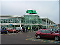
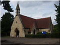

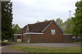

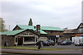
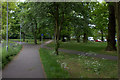
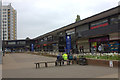

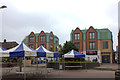
40 photos from this area
Area Information
Key information about the AL10 0EQ including its size, population, and administrative classification.
- Area Type
- Postcode
- Area Size
- 1502 m²
- Population
- 1626
- Population Density
- 6051 people/km²
House Prices in AL10 0EQ
17
Properties
£106,919
Average Sold Price
£34,000
Lowest Price
£179,950
Highest Price
Showing 17 properties
| Address | Type | Beds | Baths | Last Sale Price | Last Sale Date | |
|---|---|---|---|---|---|---|
| 154, Wordsworth Court, Middlefield, Hatfield, AL10 0EQ | Flat | - | - | £165,000 | Jun 2023 | |
| 132, Wordsworth Court, Middlefield, Hatfield, AL10 0EQ | Flat | - | - | £179,950 | May 2021 | |
| 124, Wordsworth Court, Middlefield, Hatfield, AL10 0EQ | Maisonette | 1 | 1 | £166,000 | Sep 2020 | |
| 130, Wordsworth Court, Middlefield, Hatfield, AL10 0EQ | Flat | 1 | 1 | £175,000 | Feb 2019 | |
| 134, Wordsworth Court, Middlefield, Hatfield, AL10 0EQ | Flat | 1 | 1 | £85,000 | Sep 2013 | |
| 142, Wordsworth Court, Middlefield, Hatfield, AL10 0EQ | Flat | - | - | £88,000 | Dec 2012 | |
| 146, Wordsworth Court, Middlefield, Hatfield, AL10 0EQ | Flat | - | - | £102,500 | Sep 2012 | |
| 152, Wordsworth Court, Middlefield, Hatfield, AL10 0EQ | Flat | - | - | £103,000 | May 2010 | |
| 122, Wordsworth Court, Middlefield, Hatfield, AL10 0EQ | Maisonette | 2 | - | £139,500 | Jan 2006 | |
| 128, Wordsworth Court, Middlefield, Hatfield, AL10 0EQ | Flat | 1 | 1 | £59,995 | Dec 2000 |
Page 1 of 2
Energy Efficiency in AL10 0EQ
Amenities
Schools
| Rank | School | Type | Entry gender | Ages |
|---|
Explore more schools in this area
Go to Schools tabDemographics
Household Size
One person
most common
Accommodation Type
Flats
most common
Tenure
19
majority
Ethnic Group
White
most common
Religion
N/A
most common
Household Composition
N/A
most common
Age
47
median
Adults (30-64 years)
most common
Household Deprivation
N/A
with no deprivation
NS-SEC
22
in Lower managerial occupations
Explore more demographic insights in this area
Go to Demographics tabPlanning
Planning Constraints
- Flood RiskPremium
- Ramsar Wetland SitesPremium
- Area of Outstanding Natural BeautyPremium
- Protected Nature ReservePremium
- Protected WoodlandPremium