Area Overview for AL1 5BE
Photos of AL1 5BE
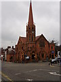


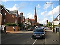
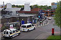
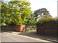
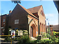
100 photos from this area
Area Information
Key information about the AL1 5BE including its size, population, and administrative classification.
- Area Type
- Postcode
- Area Size
- 6063 m²
- Population
- 1316
- Population Density
- 7235 people/km²
House Prices in AL1 5BE
41
Properties
£555,438
Average Sold Price
£82,000
Lowest Price
£1,206,000
Highest Price
Showing 41 properties
| Address | Type | Beds | Baths | Last Sale Price | Last Sale Date | |
|---|---|---|---|---|---|---|
| 7 Granville Road, St Albans, AL1 5BE | Semi-detached | 4 | 3 | £1,026,000 | May 2023 | |
| 13 Granville Road, St Albans, AL1 5BE | Semi-detached | 4 | 2 | £915,000 | Jan 2023 | |
| 25 Granville Road, St Albans, AL1 5BE | house | 5 | 3 | £1,206,000 | Oct 2022 | |
| 27 Granville Road, St Albans, AL1 5BE | house | - | - | £595,000 | Mar 2010 | |
| 11 Granville Road, St Albans, AL1 5BE | Semi-detached | 4 | 2 | £207,000 | Oct 2006 | |
| 9 Granville Road, St Albans, AL1 5BE | Semi-detached | 4 | - | £192,500 | May 1998 | |
| 1 Granville Road, St Albans, AL1 5BE | Terraced | 4 | - | £220,000 | May 1997 | |
| 31 Granville Road, St Albans, AL1 5BE | Semi-detached | 4 | 2 | £82,000 | Aug 1995 | |
| Flat 8, Granville Court, 23 Granville Road, St Albans, AL1 5BE | Flat | 1 | 1 | - | - | |
| Flat 1, Granville Court, 21 Granville Road, St Albans, AL1 5BE | Flat | 1 | 1 | - | - |
Page 1 of 5
Energy Efficiency in AL1 5BE
Amenities
Schools
| Rank | School | Type | Entry gender | Ages |
|---|
Explore more schools in this area
Go to Schools tabDemographics
Household Size
One person
most common
Accommodation Type
Flats
most common
Tenure
47
majority
Ethnic Group
White
most common
Religion
N/A
most common
Household Composition
N/A
most common
Age
47
median
Adults (30-64 years)
most common
Household Deprivation
N/A
with no deprivation
NS-SEC
63
in Lower managerial occupations
Explore more demographic insights in this area
Go to Demographics tabPlanning
Planning Constraints
- Flood RiskPremium
- Ramsar Wetland SitesPremium
- Area of Outstanding Natural BeautyPremium
- Protected Nature ReservePremium
- Protected WoodlandPremium