Area Overview for AL1 4TW
Photos of AL1 4TW
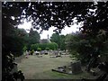
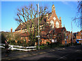
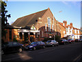


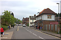
59 photos from this area
Area Information
Key information about the AL1 4TW including its size, population, and administrative classification.
- Area Type
- Postcode
- Area Size
- 7657 m²
- Population
- 1441
- Population Density
- 4452 people/km²
House Prices in AL1 4TW
9
Properties
£977,143
Average Sold Price
£315,000
Lowest Price
£1,615,000
Highest Price
Showing 9 properties
| Address | Type | Beds | Baths | Last Sale Price | Last Sale Date | |
|---|---|---|---|---|---|---|
| 37 Beaumont Avenue, St Albans, AL1 4TW | house | 5 | - | £800,000 | Dec 2020 | |
| 43 Beaumont Avenue, St Albans, AL1 4TW | house | 5 | - | £1,615,000 | Dec 2017 | |
| 37A Beaumont Avenue, St Albans, AL1 4TW | house | - | - | £1,230,000 | Dec 2017 | |
| 47 Beaumont Avenue, St Albans, AL1 4TW | Semi-detached | 6 | - | £1,425,000 | Dec 2016 | |
| 47A Beaumont Avenue, St Albans, AL1 4TW | Detached | 4 | 2 | £770,000 | May 2014 | |
| 45 Beaumont Avenue, St Albans, AL1 4TW | house | - | - | £685,000 | Nov 2005 | |
| 39 Beaumont Avenue, St Albans, AL1 4TW | Detached | - | - | £315,000 | Jun 1997 | |
| 35 Beaumont Avenue, St Albans, AL1 4TW | Semi-detached | - | - | - | - | |
| 41 Beaumont Avenue, St Albans, AL1 4TW | Detached | - | - | - | - |
Energy Efficiency in AL1 4TW
Amenities
Schools
| Rank | School | Type | Entry gender | Ages |
|---|
Explore more schools in this area
Go to Schools tabDemographics
Household Size
Family (3-5 people)
most common
Accommodation Type
Houses
most common
Tenure
88
majority
Ethnic Group
White
most common
Religion
N/A
most common
Household Composition
N/A
most common
Age
47
median
Adults (30-64 years)
most common
Household Deprivation
N/A
with no deprivation
NS-SEC
60
in Lower managerial occupations
Explore more demographic insights in this area
Go to Demographics tabPlanning
Planning Constraints
- Flood RiskPremium
- Ramsar Wetland SitesPremium
- Area of Outstanding Natural BeautyPremium
- Protected Nature ReservePremium
- Protected WoodlandPremium