Area Overview for AL1 4BG
Photos of AL1 4BG
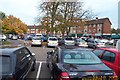
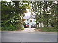
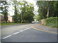
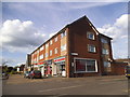
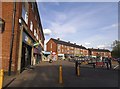
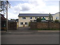
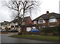
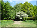
31 photos from this area
Area Information
Key information about the AL1 4BG including its size, population, and administrative classification.
- Area Type
- Postcode
- Area Size
- 2.6 hectares
- Population
- 1786
- Population Density
- 2554 people/km²
House Prices in AL1 4BG
21
Properties
£1,443,643
Average Sold Price
£640,000
Lowest Price
£2,701,000
Highest Price
Showing 21 properties
| Address | Type | Beds | Baths | Last Sale Price | Last Sale Date | |
|---|---|---|---|---|---|---|
| 35 Homewood Road, St Albans, AL1 4BG | Detached | 3 | 1 | £1,735,000 | Jan 2023 | |
| 31 Homewood Road, St Albans, AL1 4BG | Detached | 4 | 2 | £1,825,000 | Oct 2022 | |
| 25 Homewood Road, St Albans, AL1 4BG | Retail | 4 | 1 | £1,825,000 | Aug 2022 | |
| 29 Homewood Road, St Albans, AL1 4BG | house | - | - | £2,701,000 | Jan 2022 | |
| 23 Homewood Road, St Albans, AL1 4BG | house | - | - | £2,075,000 | Feb 2020 | |
| 47 Homewood Road, St Albans, AL1 4BG | house | - | - | £1,795,000 | Nov 2015 | |
| 41 Homewood Road, St Albans, AL1 4BG | Detached | 5 | 2 | £1,075,000 | Jun 2013 | |
| 17 Homewood Road, St Albans, AL1 4BG | house | 6 | - | £1,250,000 | Sep 2012 | |
| 45 Homewood Road, St Albans, AL1 4BG | house | - | - | £1,100,000 | Aug 2012 | |
| 55 Homewood Road, St Albans, AL1 4BG | Detached | 4 | - | £1,265,000 | Jun 2012 |
Page 1 of 3
Energy Efficiency in AL1 4BG
Amenities
Schools
| Rank | School | Type | Entry gender | Ages |
|---|
Explore more schools in this area
Go to Schools tabDemographics
Household Size
Family (3-5 people)
most common
Accommodation Type
Houses
most common
Tenure
91
majority
Ethnic Group
White
most common
Religion
N/A
most common
Household Composition
N/A
most common
Age
47
median
Adults (30-64 years)
most common
Household Deprivation
N/A
with no deprivation
NS-SEC
64
in Lower managerial occupations
Explore more demographic insights in this area
Go to Demographics tabPlanning
Planning Constraints
- Flood RiskPremium
- Ramsar Wetland SitesPremium
- Area of Outstanding Natural BeautyPremium
- Protected Nature ReservePremium
- Protected WoodlandPremium