Area Overview for AL1 2BZ
Photos of AL1 2BZ

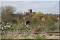
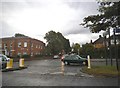
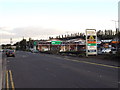
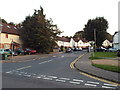
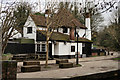
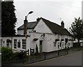
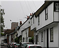
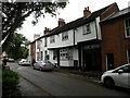
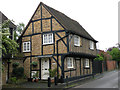
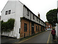
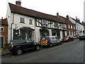
100 photos from this area
Area Information
Key information about the AL1 2BZ including its size, population, and administrative classification.
- Area Type
- Postcode
- Area Size
- 7127 m²
- Population
- 1453
- Population Density
- 6320 people/km²
House Prices in AL1 2BZ
90
Properties
£286,639
Average Sold Price
£235,000
Lowest Price
£455,000
Highest Price
Showing 90 properties
| Address | Type | Beds | Baths | Last Sale Price | Last Sale Date | |
|---|---|---|---|---|---|---|
| Flat 43, Abbott House, Everard Close, St Albans, AL1 2BZ | Flat | 1 | 1 | £235,000 | Apr 2023 | |
| Flat 45, Abbott House, Everard Close, St Albans, AL1 2BZ | Flat | 1 | 1 | £317,500 | Jun 2019 | |
| Flat 76, Abbott House, Everard Close, St Albans, AL1 2BZ | Flat | 1 | 1 | £315,000 | Apr 2019 | |
| Flat 34, Abbott House, Everard Close, St Albans, AL1 2BZ | Flat | - | - | £455,000 | Mar 2019 | |
| Flat 32, Abbott House, Everard Close, St Albans, AL1 2BZ | Flat | - | - | £325,000 | Feb 2019 | |
| Flat 38, Abbott House, Everard Close, St Albans, AL1 2BZ | Flat | - | 1 | £241,700 | Feb 2019 | |
| Flat 51, Abbott House, Everard Close, St Albans, AL1 2BZ | Flat | 1 | 1 | £307,500 | Jan 2019 | |
| Flat 62, Abbott House, Everard Close, St Albans, AL1 2BZ | Flat | 1 | 1 | £260,000 | Jan 2019 | |
| Flat 56, Abbott House, Everard Close, St Albans, AL1 2BZ | Flat | - | - | £432,000 | Jan 2019 | |
| Flat 37, Abbott House, Everard Close, St Albans, AL1 2BZ | Flat | - | - | £275,000 | Jan 2019 |
Page 1 of 9
Energy Efficiency in AL1 2BZ
Amenities
Schools
| Rank | School | Type | Entry gender | Ages |
|---|
Explore more schools in this area
Go to Schools tabDemographics
Household Size
One person
most common
Accommodation Type
Flats
most common
Tenure
50
majority
Ethnic Group
White
most common
Religion
N/A
most common
Household Composition
N/A
most common
Age
47
median
Adults (30-64 years)
most common
Household Deprivation
N/A
with no deprivation
NS-SEC
60
in Lower managerial occupations
Explore more demographic insights in this area
Go to Demographics tabPlanning
Planning Constraints
- Flood RiskPremium
- Ramsar Wetland SitesPremium
- Area of Outstanding Natural BeautyPremium
- Protected Nature ReservePremium
- Protected WoodlandPremium