Area Overview for AL1 2BJ
Photos of AL1 2BJ
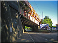
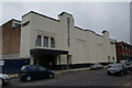
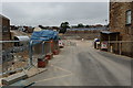
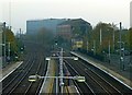
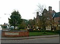
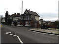
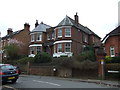
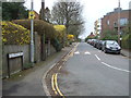
100 photos from this area
Area Information
Key information about the AL1 2BJ including its size, population, and administrative classification.
- Area Type
- Postcode
- Area Size
- 3331 m²
- Population
- 1621
- Population Density
- 1745 people/km²
House Prices in AL1 2BJ
14
Properties
£463,250
Average Sold Price
£70,500
Lowest Price
£875,000
Highest Price
Showing 14 properties
| Address | Type | Beds | Baths | Last Sale Price | Last Sale Date | |
|---|---|---|---|---|---|---|
| 8 Mentmore Road, St Albans, AL1 2BJ | Terraced | 3 | 2 | £750,000 | Aug 2024 | |
| 18 Mentmore Road, St Albans, AL1 2BJ | house | 3 | 2 | £725,000 | Jul 2023 | |
| 6 Mentmore Road, St Albans, AL1 2BJ | house | - | - | £575,000 | Jan 2022 | |
| 2 Mentmore Road, St Albans, AL1 2BJ | house | - | - | £875,000 | Sep 2020 | |
| 12 Mentmore Road, St Albans, AL1 2BJ | house | 2 | 1 | £375,000 | Apr 2014 | |
| 14 Mentmore Road, St Albans, AL1 2BJ | house | 2 | - | £312,000 | Aug 2012 | |
| 16 Mentmore Road, St Albans, AL1 2BJ | house | - | - | £355,000 | Jul 2012 | |
| 10 Mentmore Road, St Albans, AL1 2BJ | Terraced | - | - | £320,000 | Aug 2007 | |
| 24 Mentmore Road, St Albans, AL1 2BJ | house | - | - | £275,000 | Mar 2004 | |
| 22 Mentmore Road, St Albans, AL1 2BJ | Semi-detached | - | - | £70,500 | Mar 1996 |
Page 1 of 2
Energy Efficiency in AL1 2BJ
Amenities
Schools
| Rank | School | Type | Entry gender | Ages |
|---|
Explore more schools in this area
Go to Schools tabDemographics
Household Size
Family (3-5 people)
most common
Accommodation Type
Houses
most common
Tenure
81
majority
Ethnic Group
White
most common
Religion
N/A
most common
Household Composition
N/A
most common
Age
47
median
Adults (30-64 years)
most common
Household Deprivation
N/A
with no deprivation
NS-SEC
61
in Lower managerial occupations
Explore more demographic insights in this area
Go to Demographics tabPlanning
Planning Constraints
- Flood RiskPremium
- Ramsar Wetland SitesPremium
- Area of Outstanding Natural BeautyPremium
- Protected Nature ReservePremium
- Protected WoodlandPremium