Area Overview for Abbess Beauchamp and Berners Roding
Photos of Abbess Beauchamp and Berners Roding
Area Information
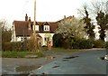
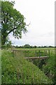
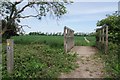
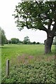
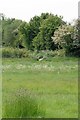
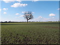
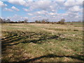
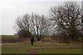
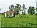
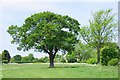
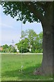
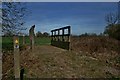
Abbess Beauchamp and Berners Roding stands out as a historic civil parish in the Epping Forest district of Essex, situated in the upper Roding Valley. This area combines the former villages of Abbess Roding, Beauchamp Roding, and Berners Roding, which merged into a single parish in 1946. Covering 16.0 km², the parish offers a quiet existence rooted in Anglo-Saxon history, originally settled by the Hroðingas tribe. You will find yourself living in a landscape named after the River Roding, with coordinates placing it near CM5 0JZ. The population sits at approximately 2,464 residents, creating a sense of established community without the density of larger towns. Daily life here revolves around a deep heritage, witnessed in St Edmund's Church, a Grade II* listed building featuring a 15th-century oak rood screen and a Norman-style font. You are surrounded by sites of architectural significance, including the church in Abbess Roding, which dates mainly to the 14th and 15th centuries. This setting provides a tangible link to the past, from the parish formed in 1946 back to the Abbey of Ely's early holdings. Living in Abbess Beauchamp and Berners Roding means choosing a location defined by historical layers and a small-scale environment rather than modern urban sprawl.
- Area Type
- Parish
- Area Size
- 16.0 km²
- Population
- Not available
- Population Density
- Not available
Demographics
The community profile reflects a settlement designed for those who value stability. With a median age of 70, the population skews significantly towards older age groups. This demographic suggests that the area appeals largely to retirees or long-term residents rather than young families seeking childhood proximity to neighbours. Home ownership stands at 74%, indicating that the vast majority of households have purchased their residences outright or through a mortgage, fostering a settled population with roots in the locality. The data shows a high level of permanent residency within the parish boundaries. While specific figures on ethnic diversity and religious affiliation are not detailed in the provided records, the overall household composition points to a traditional living pattern. The majority of accommodation is likely owned outright given the high ownership rate compared to rental markets elsewhere. You can expect the population to remain relatively consistent in its age profile, meaning local services cater to an older demographic. This demography distinguishes Abbess Beauchamp and Berners Roding from younger, more transient districts. The 74% ownership rate excludes a significant portion of the population from renting, reinforcing the character of a tenure-based community where residents have lived in their specific homes within the parish for extended periods.
Household Size
Accommodation Type
Tenure
Ethnic Group
Religion
Household Composition
Age
Household Deprivation
NS-SEC
Explore more demographic insights in this area
Go to Demographics tabPlanning
Planning Constraints
- Flood RiskLocked
- Ramsar Wetland SitesLocked
- Area of Outstanding Natural BeautyLocked
- Protected Nature ReserveLocked
- Protected WoodlandLocked
- Crime RiskLocked