Area Overview for Wycliffe Ward
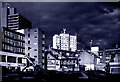
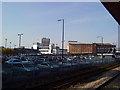
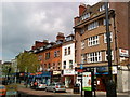
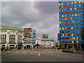
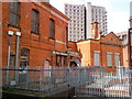
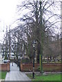
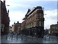
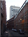
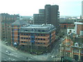
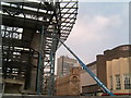
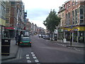
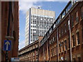
Photos of Wycliffe Ward
Area Information
Wycliffe Ward is a distinct district ward located within the administrative boundary of Leicester in the East Midlands. This specific area covers just 1.1 square kilometres but accommodates a population of 2,206 residents. You will find this ward situated in the urban fabric of the city, making it a relatively compact neighbourhood for daily exploration. Because the area is small, distances between homes and local amenities tend to be short. The density here is high, with 2,033 people living per square kilometre, which creates a closely knit environment. Living in Wycliffe Ward means navigating an urban setting where space is utilised efficiently. The ward forms part of the broader Leicester City Council structure, ensuring it receives standard municipal services while maintaining its own local identity. Prospective buyers should recognise that you are entering a defined urban zone within a larger city context. The compact size suggests a neighbourhood where much of daily life happens within reasonable walking distances from your doorstep. This concentration of residents supports specific local commerce and creates a defined sense of place that distinguishes the ward from more sprawling suburbs.
- Area Type
- District Borough Unitary Ward
- Area Size
- 1.1 km²
- Population
- 2206
- Population Density
- 2033 people/km²
Demographics
The community profile of Wycliffe Ward reflects an older population cohort. The median age within the ward stands at 70 years, indicating that the majority of residents are senior citizens. You will find that the age distribution skews heavily towards this demographic, making it a retirement-focused locale rather than a family hub with young children. Regarding housing tenure, just 37% of households own their homes outright or with a mortgage. The remaining majority of residents likely rent their accommodation from social or private landlords. This low ownership rate suggests a community reliant on renting or facing barriers to property purchase. With a median age of 70, household compositions will predominantly feature single-person homes or couples living together without dependent children. The ward contains no specific data on predominant ethnic groups or religious affiliations within this dataset. These demographic figures highlight a clear community dynamic characterised by senior living arrangements and a significant proportion of the population who do not own their property. Homebuyers considering this area must understand that the social fabric is defined by an ageing population with specific housing needs.
Household Size
Accommodation Type
Tenure
Ethnic Group
Religion
Household Composition
Age
Household Deprivation
NS-SEC
Explore more demographic insights in this area
Go to Demographics tabPlanning
Planning Constraints
- Flood RiskPremium
- Ramsar Wetland SitesPremium
- Area of Outstanding Natural BeautyPremium
- Protected Nature ReservePremium
- Protected WoodlandPremium
- Crime RiskPremium