Area Overview for Wormhill
Photos of Wormhill

Area Information
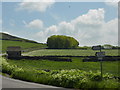
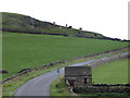
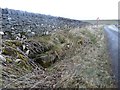
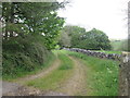
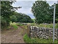
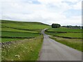
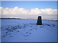
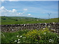
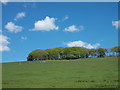
Living in Wormhill means residing within a civil parish that covers a substantial 19.1 km². You are stepping away from the rapid pace of urban centres to find a setting defined by its quiet character and established rural feel. This area is not a sprawling metropolis but a compact community where the landscape shapes daily life. The parish offers a distinct environment for those seeking a pace of life controlled by nature rather than traffic or crowds. You will find that the boundaries of Wormhill provide a clear separation from denser development, allowing for a more personal connection to the surroundings. Prospective buyers often look here because the space allows for a sense of independence often unavailable in larger towns. The physical scale of the parish supports a lifestyle where the immediate environment is familiar to residents. You do not need to travel far to encounter the specific features that define the location, yet you benefit from the privacy that comes with lower density living. The area presents a straightforward choice for anyone prioritising peace over proximity to major commercial hubs. This profile matches well with individuals who value a predictable routine and a clear understanding of their local boundaries.
- Area Type
- Parish
- Area Size
- 19.1 km²
- Population
- Not available
- Population Density
- Not available
Demographics
The community in Wormhill reflects a clear preference for stability and long-term settlement. A striking 73% of households own their homes, indicating that the majority of residents have placed their roots here. This high rate of home ownership suggests a population that stays put rather than moving frequently. The demographic profile reinforces this; the median age reaches 70, placing a significant portion of the population in the older age bracket. This figure likely influences the noise levels, community speed, and social priorities within the parish. You will encounter a community where life stages may be more focused on retirement or late-life living than on raising young families in large numbers. The age distribution creates an environment where quieter neighbourhoods and established routines take precedence. While the data does not specify exact household composition breakdowns beyond the total, the dominance of older residents often correlates with specific local service needs, such as healthcare access and accessible transport. The ethnic and religious profiles remain unspecified in the current records, meaning the visible culture is likely shaped by the historical settlement patterns typical of this rural parish. For those considering homes in Wormhill, the key takeaway is a mature, settled population with a strong commitment to property ownership.
Household Size
Accommodation Type
Tenure
Ethnic Group
Religion
Household Composition
Age
Household Deprivation
NS-SEC
Explore more demographic insights in this area
Go to Demographics tabPlanning
Planning Constraints
- Flood RiskPremium
- Ramsar Wetland SitesPremium
- Area of Outstanding Natural BeautyPremium
- Protected Nature ReservePremium
- Protected WoodlandPremium
- Crime RiskPremium