Area Overview for Worksop North West Ward
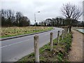
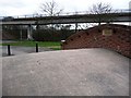
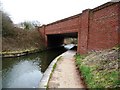
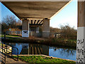
Photos of Worksop North West Ward
Area Information
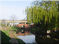
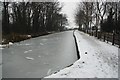
Living in Worksop North West Ward offers a settled residential experience within the smaller unitary authority of Worksop. This district borough unitary ward covers an area of 8.8 square kilometres, making it a compact community. You will find a distinct demographic profile that shapes the daily rhythm of life here. The population skews significantly towards older residents, with a median age of 70. This indicates a neighbourhood dominated by retirees and those planning their retirement years. The community is characterised by a high degree of permanence rather than transient movement. Most residents have chosen this location for long-term stability. You live in an area where the social fabric is woven from decades of established households. The housing stock reflects a generation that prioritised ownership. Exactly 63% of households own their homes outright or have a mortgage. This high ownership rate contrasts with urban centres where rental properties dominate the landscape. In Worksop North West Ward, you buy into a legacy of tenure rather than leasing a temporary arrangement. The ward lacks major planning constraints for large-scale new development alongside existing structures. The environment presents a balanced mix of accessibility and natural considerations. You will encounter protected woodland within the ward boundaries. This feature adds green space to the 8.8 square kilometre footprint but also introduces specific planning limitations. While the area passes safety checks for flood risk and Ramsar wetland sites, the presence of protected trees or trees means future developments might face restrictions. Crime rates sit at a medium level with a safety score of 52. Standard precautions remain advisable for all residents. Digital connectivity remains robust, with a broadband quality score of 94, ensuring reliable internet access for remote work or leisure.
- Area Type
- District Borough Unitary Ward
- Area Size
- 8.8 km²
- Population
- Not available
- Population Density
- Not available
Demographics
The community in Worksop North West Ward is defined by a clear age profile. Residents here are, on average, 70 years old. This median age places the ward firmly within the category of older demographics compared to national averages. You are looking at a neighbourhood where grandchildren are common visitors rather than the primary demographic. The data does not specify a most common age range beyond the total population count, but the median figure dictates the social character. Home ownership stands at exactly 63% within the ward. This figure suggests that two-thirds of residents have achieved or maintained homeownership. The remaining third likely comprises investor landlords, recent movers, or those purchasing later in life. Household composition data is recorded as a total figure without breakdowns into single-person or multi-generational living arrangements. Accommodation types are similarly listed as a total without specific detail on semi-detached, terraced, or detached categories. Ethnic diversity and religious affiliation are recorded as totals without further granularity in the available records. This lack of specific breakdown does not alter the fundamental nature of the community. The high median age and strong ownership rate suggest a quiet, established suburb. You will find neighbours who have lived there for decades. Houses in Worksop North West Ward reflect this stability. Deprivation indicators are not explicitly detailed in the current dataset, but the high ownership rate often correlates with financial security. Quality of life here centres on stability rather than rapid growth or high mobility.
Household Size
Accommodation Type
Tenure
Ethnic Group
Religion
Household Composition
Age
Household Deprivation
NS-SEC
Explore more demographic insights in this area
Go to Demographics tabPlanning
Planning Constraints
- Flood RiskPremium
- Ramsar Wetland SitesPremium
- Area of Outstanding Natural BeautyPremium
- Protected Nature ReservePremium
- Protected WoodlandPremium
- Crime RiskPremium