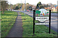
Area Overview for Worksop North Ward
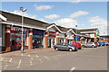
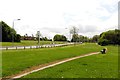
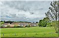
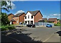
Photos of Worksop North Ward
Area Information
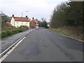
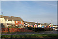
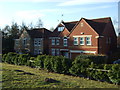
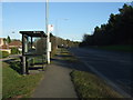
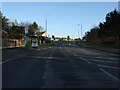
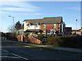
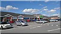
Living in Worksop North Ward offers a distinct residential experience within Nottinghamshire. This district borough unitary ward spans an area of 3.7 square kilometres, creating a relatively compact community where neighbours often know one another. The location stands out for its blend of settled housing and established local character, making it a considered choice for those seeking a specific slice of life near Worksop. Residents here navigate a defined boundary that encapsulates local amenities and daily routines, away from the larger urban sprawl. The character of the ward reflects a mature settlement pattern. You will find a population settled into homes that have been built over generations, contributing to a stable neighbourhood feel. Daily life involves a rhythm shaped by this established footprint rather than rapid development. The small geographical size means distances are walkable for many local needs, yet the ward retains the feel of a distinct planning unit within the wider borough structure. This makes it an accessible option for buyers who value a manageable living environment. When you consider buying a home in this ward, you enter a space where the built environment has a clear identity. The physical scale supports a self-contained quality of life, reducing reliance on long commutes for everyday activities. It is a place where the community has defined itself without the influx of sudden large-scale projects. This stability is evident in the way locals engage with their immediate surroundings, fostering a sense of familiarity that defines the lived experience of Worksop North Ward.
- Area Type
- District Borough Unitary Ward
- Area Size
- 3.7 km²
- Population
- Not available
- Population Density
- Not available
Demographics
You will find a very mature community when living in Worksop North Ward. The median age for residents is 70, indicating that the population skews significantly older than the national average. This age profile means the ward is dominated by retirees and long-term residents rather than young professionals or growing families. The demographic data does not specify a single most common age range beyond the total population breakdown, but the high median figure is the defining characteristic of the area. Home ownership is the primary model of accommodation here, with 79% of households owning their homes outright or with a mortgage. This figure is substantial compared to many other parts of the UK, reflecting a neighbourhood where residents have planted deep roots. The high level of ownership suggests a stable community with low turnover of residents. You are unlikely to encounter a transient rental market dominating the streets in this specific ward. The data provided does not detail the specific breakdown of household composition types, such as the number of single-person versus multi-generational homes. However, the age profile strongly implies that many of these tied-down homeowners reside with spouses or are living alone. Diversity metrics for predominant ethnic groups and religious affiliations are not included in the available statistics, so the community appears culturally homogenous based on the lack of specific figures. The environment is defined by this older, property-owning cohort rather than transient or diverse demographic shifts.
Household Size
Accommodation Type
Tenure
Ethnic Group
Religion
Household Composition
Age
Household Deprivation
NS-SEC
Explore more demographic insights in this area
Go to Demographics tabPlanning
Planning Constraints
- Flood RiskPremium
- Ramsar Wetland SitesPremium
- Area of Outstanding Natural BeautyPremium
- Protected Nature ReservePremium
- Protected WoodlandPremium
- Crime RiskPremium