Area Overview for Woodford and Weedon Ward
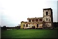
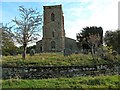
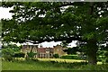
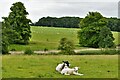
Photos of Woodford and Weedon Ward
Area Information
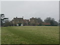
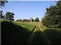
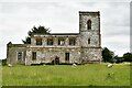
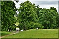
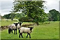
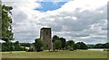
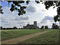
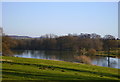
Woodford and Weedon Ward is a distinct district within the Borough of South Northamptonshire, covering 137.3 square kilometres. You might expect a large area to support tens of thousands of residents, yet this ward has a population of just 2,412 people. This results in a population density of only 1,015 people per square kilometre, creating a notably low-density environment. The geography is defined by significant open space, which shapes the daily rhythm of life away from the intensity of urban centres. Living in Woodford and Weedon Ward means accessing a wide expanse of land where residents do not share space with large neighbours. The area encompasses specific wards named Woodford and Weedon, anchoring the community identity of this substantial territory. For prospective homebuyers, the sheer size of the ward suggests a setting where nature and quietude take priority over convenience. You will find yourself in a locality where the average number of people living nearby is far lower than in most English districts. This spatial arrangement offers a level of privacy that is rare in modern planning, making the area suitable for those seeking a expansive lifestyle rather than a dense urban one. The distinct lack of crowding allows for a pace of living that differs markedly from the rest of the county.
- Area Type
- District Borough Unitary Ward
- Area Size
- 137.3 km²
- Population
- 2412
- Population Density
- 1015 people/km²
Demographics
The community within Woodford and Weedon Ward defines itself through an older demographic profile, with a median age of 70 years. This statistic indicates that half of all residents are older than this threshold, while the majority fall into younger age brackets. The most common age grouping listed in the data is simply "Total", but the median figure remains the most reliable indicator of the area's character. A total population of 2,412 residents contributes to a stable but limited community dynamism. Home ownership stands at 80 per cent, a figure that represents the council ward level data for this location. Such a high rate suggests that most households are settled owners rather than long-term tenants. The area does not display significant diversity markers within the provided data, which points to a relatively homogeneous resident base. Religion and predominant ethnic group data are not detailed in the specific breakdowns, reinforcing the traditional profile of the area. Deprivation details are not explicitly quantified in the current dataset, but the high ownership rate typically correlates with financial stability. You can expect a neighbourhood where long-term residency is the norm, as evidenced by the ownership figure. The age structure means services and institutions cater primarily to an established, mature population rather than young families.
Household Size
Accommodation Type
Tenure
Ethnic Group
Religion
Household Composition
Age
Household Deprivation
NS-SEC
Explore more demographic insights in this area
Go to Demographics tabPlanning
Planning Constraints
- Flood RiskPremium
- Ramsar Wetland SitesPremium
- Area of Outstanding Natural BeautyPremium
- Protected Nature ReservePremium
- Protected WoodlandPremium
- Crime RiskPremium