Area Overview for Woodend
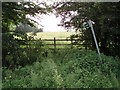
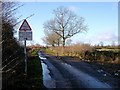
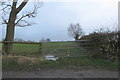
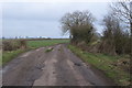
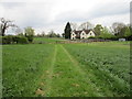
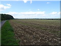
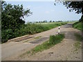
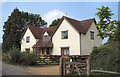
Photos of Woodend
Area Information
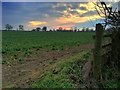
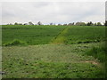
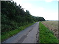
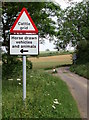
Woodend is a small civil parish covering an area of 7.1 square kilometres in England. You will find this settlement is defined by a quiet, rural character rather than the pace of a larger town. Living in Woodend means you are part of a community with very few large-scale planning constraints. The parish passes assessments for flood risk, Ramsar wetland sites, and areas of outstanding natural beauty, indicating you will face few statutory barriers when looking at homes in this locale. However, you should check for protected woodland before committing to a purchase, as the area contains safeguards around existing timber. Daily life here is stable and low-risk from a safety perspective, with crime rates sitting well below the national average. You are looking at an environment designed for those who prefer stability over rapid development. The landscape offers open space without the strict protections that might complicate future building projects. This balance of freedom and natural preservation defines the experience of moving to Woodend. You can settle here knowing that major environmental hazards are not present, allowing you to focus on the suitability of individual plots for your specific needs. The parish remains a practical choice for buyers seeking a straightforward introduction to countryside living. # The community in Woodend presents a distinct profile for anyone considering homes in the parish. The typical resident here has a median age of 70, which indicates a population that is significantly older than the national average. Most households fall into the 'age total' category, suggesting a wide spread of living arrangements suited to mature residents. Home ownership is high, with 79 per cent of properties owned outright. This figure tells you that the area is dominated by long-term owners rather than landlords or temporary tenants. You are unlikely to encounter a volatile rental market here. The demographic structure points to a settled neighbourhood where residents have roots in the village. This stability often translates into a tight-knit social fabric and consistent local support networks. When planning your move, expect a cohort of neighbours who have shaped the local culture over many years. The high rate of occupancy suggests that space and facilities are tailored to an older demographic. There is no indication of transient populations or significant gentrification pressures. Instead, you are joining a group of people who value security and permanence. This data confirms that Woodend is best suited for those who want a permanent base rather than a stepping stone in their lives. # The property market in Woodend reflects a stable environment characterised by high levels of private ownership. With 79 per cent of the housing stock owned by its residents, this parish functions as a traditional owner-occupied community. You will find that the majority of homes in Woodend are held by families or individuals who intend to live there for the long term. This dynamic often means properties sell through slower than in rapid-growth areas, requiring you to be patient when making an offer. The accommodation types cater to the specific needs of the local population, favouring efficiency and sustainability over speculative development. Because most residents are owners, tenant vacancies are rare, and the rental sector remains a minor component of the local economy. When you look at available homes, you are likely to encounter a range of settled dwellings rather than developer-led estates. The market resilience here is underpinned by this strong base of owner-occupiers. You do not need to worry about sudden rent increases or shifting tenant policies because the land is mostly tied up in permanent residences. This consistency provides peace of mind for buyers who prioritise security in their investment. The housing landscape remains largely unchanged by external market fluctuations, offering a predictable path for those wishing to settle down in a rural parish. # Digital connectivity in Woodend presents a clear trade-off for residents who work online or rely heavily on the internet. Mobile network quality scores highly with an index of 84 out of 100, meaning you can generally expect excellent coverage for your phone regardless of where you roam within the parish. Calls, texts, and mobile data will function smoothly for most of your daily activities. However, fixed broadband quality presents a significant challenge for remote working. The broadband score sits at just 26 out of 100, which classifies the connection speed and reliability as poor. You cannot depend on high-speed fibre for video conferencing or large file uploads if your job requires it. This limitation is critical for anyone in a household where multiple people need simultaneous online access. If you plan to work from home, you must verify the specific connection speed with the nearest Internet Service Provider before making an offer on a property. The disparity between strong mobile signals and weak fixed lines is a defining feature of the digital landscape here. You will need to work around these constraints, perhaps using mobile hotspots as a backup solution. Living in Woodend is feasible for many, but it requires a realistic assessment of your digital needs versus the available infrastructure. # Safety and environmental factors in Woodend offer a balanced picture of risk that every homebuyer should accept before purchasing. From a crime perspective, the area performs strongly with a safety score of 92 out of 100. This indicates a passive safety level where you can expect crime rates well below the national average. You are moving into one of the townships with the lowest likelihood of burglary or antisocial behaviour. However, environmental planning presents one specific constraint you must investigate. The parish contains protected woodland covering 0.39 per cent of its area. This assessment triggers a warning on your planning application checks, meaning you cannot build on trees without special permission. Fortunately, there is no flood risk, with a low coverage score of 2.95, and no constraints from Ramsar sites or Areas of Outstanding Natural Beauty. The absence of these major planning restrictions simplifies the process for new builds in non-wooded areas. You can construct new homes in open spaces without fearing strict environmental vetoes. The combination of high safety scores and manageable planning constraints makes the area practical for living while preserving its natural features. Only the protected woodlands require your careful attention during the planning phase. # Is Woodend a good place for people who work from home?Woodend scores 84 out of 100 for mobile coverage, making calls and basic data reliable. However, the fixed broadband score is only 26 out of 100. This poor wired connection may hinder large video conferences or file transfers for digital workers. You must confirm high-speed alternatives with providers before buying. What is the age profile of the community?The median age in Woodend is 70 years old. This indicates a mature neighbourhood where most residents are retired or in later life. You are moving into an area dominated by older homeowners rather than young families or transient workers. Are there any planning restrictions I should be aware of?Woodend passes checks for flood risk, wetlands, and outstanding natural beauty. However, you must be cautious about the 0.39 per cent of the area designated as protected woodland. This warning means you will need special permission to build on trees within that specific zone. How safe is the neighbourhood compared to the rest of the country?Safety risk is very low with a score of 92 out of 100. This places Woodend in the minority of areas with below-average crime rates. You can expect a quiet environment with minimal worry regarding theft or anti-social behaviour.
- Area Type
- Parish
- Area Size
- 7.1 km²
- Population
- Not available
- Population Density
- Not available
Demographics
The community in Woodend presents a distinct profile for anyone considering homes in the parish. The typical resident here has a median age of 70, which indicates a population that is significantly older than the national average. Most households fall into the 'age total' category, suggesting a wide spread of living arrangements suited to mature residents. Home ownership is high, with 79 per cent of properties owned outright. This figure tells you that the area is dominated by long-term owners rather than landlords or temporary tenants. You are unlikely to encounter a volatile rental market here. The demographic structure points to a settled neighbourhood where residents have roots in the village. This stability often translates into a tight-knit social fabric and consistent local support networks. When planning your move, expect a cohort of neighbours who have shaped the local culture over many years. The high rate of occupancy suggests that space and facilities are tailored to an older demographic. There is no indication of transient populations or significant gentrification pressures. Instead, you are joining a group of people who value security and permanence. This data confirms that Woodend is best suited for those who want a permanent base rather than a stepping stone in their lives. # The property market in Woodend reflects a stable environment characterised by high levels of private ownership. With 79 per cent of the housing stock owned by its residents, this parish functions as a traditional owner-occupied community. You will find that the majority of homes in Woodend are held by families or individuals who intend to live there for the long term. This dynamic often means properties sell through slower than in rapid-growth areas, requiring you to be patient when making an offer. The accommodation types cater to the specific needs of the local population, favouring efficiency and sustainability over speculative development. Because most residents are owners, tenant vacancies are rare, and the rental sector remains a minor component of the local economy. When you look at available homes, you are likely to encounter a range of settled dwellings rather than developer-led estates. The market resilience here is underpinned by this strong base of owner-occupiers. You do not need to worry about sudden rent increases or shifting tenant policies because the land is mostly tied up in permanent residences. This consistency provides peace of mind for buyers who prioritise security in their investment. The housing landscape remains largely unchanged by external market fluctuations, offering a predictable path for those wishing to settle down in a rural parish. # Digital connectivity in Woodend presents a clear trade-off for residents who work online or rely heavily on the internet. Mobile network quality scores highly with an index of 84 out of 100, meaning you can generally expect excellent coverage for your phone regardless of where you roam within the parish. Calls, texts, and mobile data will function smoothly for most of your daily activities. However, fixed broadband quality presents a significant challenge for remote working. The broadband score sits at just 26 out of 100, which classifies the connection speed and reliability as poor. You cannot depend on high-speed fibre for video conferencing or large file uploads if your job requires it. This limitation is critical for anyone in a household where multiple people need simultaneous online access. If you plan to work from home, you must verify the specific connection speed with the nearest Internet Service Provider before making an offer on a property. The disparity between strong mobile signals and weak fixed lines is a defining feature of the digital landscape here. You will need to work around these constraints, perhaps using mobile hotspots as a backup solution. Living in Woodend is feasible for many, but it requires a realistic assessment of your digital needs versus the available infrastructure. # Safety and environmental factors in Woodend offer a balanced picture of risk that every homebuyer should accept before purchasing. From a crime perspective, the area performs strongly with a safety score of 92 out of 100. This indicates a passive safety level where you can expect crime rates well below the national average. You are moving into one of the townships with the lowest likelihood of burglary or antisocial behaviour. However, environmental planning presents one specific constraint you must investigate. The parish contains protected woodland covering 0.39 per cent of its area. This assessment triggers a warning on your planning application checks, meaning you cannot build on trees without special permission. Fortunately, there is no flood risk, with a low coverage score of 2.95, and no constraints from Ramsar sites or Areas of Outstanding Natural Beauty. The absence of these major planning restrictions simplifies the process for new builds in non-wooded areas. You can construct new homes in open spaces without fearing strict environmental vetoes. The combination of high safety scores and manageable planning constraints makes the area practical for living while preserving its natural features. Only the protected woodlands require your careful attention during the planning phase. # Is Woodend a good place for people who work from home?Woodend scores 84 out of 100 for mobile coverage, making calls and basic data reliable. However, the fixed broadband score is only 26 out of 100. This poor wired connection may hinder large video conferences or file transfers for digital workers. You must confirm high-speed alternatives with providers before buying. What is the age profile of the community?The median age in Woodend is 70 years old. This indicates a mature neighbourhood where most residents are retired or in later life. You are moving into an area dominated by older homeowners rather than young families or transient workers. Are there any planning restrictions I should be aware of?Woodend passes checks for flood risk, wetlands, and outstanding natural beauty. However, you must be cautious about the 0.39 per cent of the area designated as protected woodland. This warning means you will need special permission to build on trees within that specific zone. How safe is the neighbourhood compared to the rest of the country?Safety risk is very low with a score of 92 out of 100. This places Woodend in the minority of areas with below-average crime rates. You can expect a quiet environment with minimal worry regarding theft or anti-social behaviour.
Household Size
Accommodation Type
Tenure
Ethnic Group
Religion
Household Composition
Age
Household Deprivation
NS-SEC
Explore more demographic insights in this area
Go to Demographics tabPlanning
Planning Constraints
- Flood RiskPremium
- Ramsar Wetland SitesPremium
- Area of Outstanding Natural BeautyPremium
- Protected Nature ReservePremium
- Protected WoodlandPremium
- Crime RiskPremium