Area Overview for Wollaston
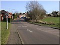
Photos of Wollaston


Area Information
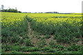
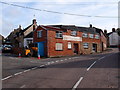
Wollaston is a built-up area spanning just 1.2 km², which creates a tightly knit environment rather than a sprawling town. You will find that living in Wollaston means moving into a compact, concentrated community where daily routines do not require long commutes locally. The small footprint means that the distance between your home, local shops, and community hubs is minimal. This layout suits those who prefer a walkable environment where neighbourhood connections feel immediate and personal. While the area lacks the extensive infrastructure of a large city, its size ensures that you can navigate most of your daily needs without driving far. The character here is defined by this density, offering a sense of closeness that larger settlements often dilute. When you consider homes in Wollaston, you are choosing an location where the built environment dominates, reinforcing a self-contained lifestyle. There is little room for error or getting lost, which provides a sense of security and familiarity for residents and newcomers alike.
- Area Type
- Built Up Area 250
- Area Size
- 1.2 km²
- Population
- Not available
- Population Density
- Not available
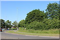
Daily life in Wollaston is facilitated by a cluster of nearby amenities within practical reach of residents. You can buy groceries at Co-op Wollaston, located directly in the area, or visit Co-op Irchester for comparable provisions. If you prefer the wider options of a larger town, Tesco Wellingborough remains accessible via the local transport routes. Beyond retail, you have access to a railway station in Wellingborough, which serves as a key transport hub for connecting to other regions. There are five retail venues noted as being nearest to your home, ensuring you can source most daily requirements locally. While the area is built up, the presence of these specific commercial centres and transport links means you do not have to travel far for basic needs. This concentration of services supports a straightforward lifestyle where convenience remains a priority for households settled here.
Amenities
Schools
Families considering schools near Wollaston will find several options concentrated within the area. You can attend Wollaston Community Primary School, which serves as a local institution for younger children. There is also Wollaston Primary School holding a good Ofsted rating, providing a verified standard of education in the neighbourhood. A third option, Wollaston School listed as a primary provider, offers another choice for local families. Beyond primary education, Wollaston School operates as an academy with a good Ofsted rating, indicating a solid framework for curriculum delivery. This mix allows you to evaluate different teaching styles within a short distance of your home. The presence of these specific institutions means you do not need to look far for education for young children. Families can choose between the community-focused model and the academy structure based on their preferences.
| Rank | School | Type | Entry gender | Ages |
|---|
Explore more schools in this area
Go to Schools tabDemographics
The community profile in Wollaston reveals a distinctly mature population. The median age sits at 70 years, which indicates that a significant portion of the residents are retired or approaching retirement age. This age structure shapes the social rhythm of the area, where life often revolves around leisure and stability rather than the demands of raising young families. You will encounter a household with an emphasis on long-term settlement, as 72% of residents own their homes outright. This high percentage of home ownership suggests that the area attracts people seeking permanence rather than short-term rentals. Accommodation types align with this demographic, likely featuring terraced houses and flats suited to older occupants. The data does not specify the predominant ethnic group or religious composition, but the clear age demographic defines the daily life of the neighbourhood. You will find that living in Wollaston involves engaging with a generation that has deep roots in the region, creating a stable social fabric where local knowledge is widely shared.
Household Size
Accommodation Type
Tenure
Ethnic Group
Religion
Household Composition
Age
Household Deprivation
NS-SEC
Explore more demographic insights in this area
Go to Demographics tabPlanning
Planning Constraints
- Crime RiskPremium