Area Overview for Wing
Photos of Wing
Area Information
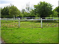
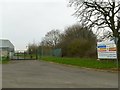
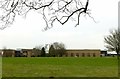
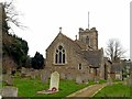
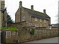
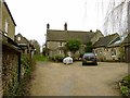
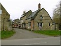
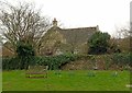
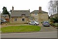
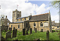
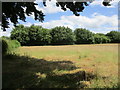
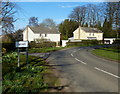
Living in Wing means embracing a distinctly rural lifestyle within a civil parish defined by deep historical roots and open countryside. This small village occupies only 4.5 square kilometres in Central Bedfordshire, positioned just three miles west of Leighton Buzzard and on the A418 road connecting Aylesbury and the town centre. Residents enjoy proximity to Milton Keynes while retaining the quiet of a place first mentioned in the Domesday Book of 1086. The area is characterised by significant heritage sites, including the Anglo-Saxon Church of All Saints, which has served a congregation for over 1300 years, and the visible earthworks of a Norman motte-and-bailey castle at Castle Hill. Daily life revolves around a sense of permanence and history, evidenced by the presence of the Rothschild family home at Ascott House and a village hall built in their style in 1905. You are surrounded by the ancient landscape of the Icknield Way, although the track is less used today than in Roman times. The community feels intimate and established, with house ownership rates that attest to long-term residency rather than transient renting. There is no smoke from distant cities on the horizon, just the views typical of this_located parish. Whether you value access to a former RAF base history or the tranquil atmosphere of a peninsula of land near a nature-rich region, Wing offers a grounded existence far removed from the pace of larger urban centres.
- Area Type
- Parish
- Area Size
- 4.5 km²
- Population
- Not available
- Population Density
- Not available
Demographics
The community in Wing is defined by a very senior demographic, with a median age of 70 years. This statistic indicates that the majority of residents are retirees or older adults who have chosen to settle in this rural parish. The age profile suggests a quiet, stable population where the pace of life matches the slower rhythm of village living. There is a notable lack of young families or students, creating an environment where weekday streets may appear particularly empty. Home ownership stands at an impressive 73% of households. This high figure confirms that the village is predominantly an owner-occupied area where families have built long-term roots. Only a small fraction of residents rent their homes, which contributes to the stability of the neighbourhood. The data does not specify household composition details beyond the general total, but the high ownership rate implies that most people live in properties they have purchased rather than rented accommodation. There is no indication of significant ethnic diversity or religious clustering in the provided statistics, suggesting a homogenous community of local residents. For those considering homes in Wing, you should expect a market dominated by detached or semi-detached properties owned by older couples. The demographic reality means that local shops and services will likely cater to older tastes rather than the demands of a young family demographic. You might find yourself joining clubs or hobby groups where you meet neighbours of a similar vintage. The village hall, built in 1905, likely serves as a central meeting point for social activities among this age group.
Household Size
Accommodation Type
Tenure
Ethnic Group
Religion
Household Composition
Age
Household Deprivation
NS-SEC
Explore more demographic insights in this area
Go to Demographics tabPlanning
Planning Constraints
- Flood RiskPremium
- Ramsar Wetland SitesPremium
- Area of Outstanding Natural BeautyPremium
- Protected Nature ReservePremium
- Protected WoodlandPremium
- Crime RiskPremium