Area Overview for Wilsford
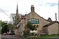
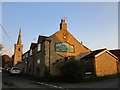
Photos of Wilsford


Area Information
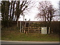
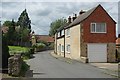
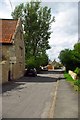
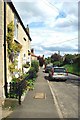
Living in Wilsford means settling into a built-up area that feels distinct from larger urban centres. This location spans 21.1 hectares and sits within the broader context of England. The scale of the area suggests a contained community where daily life often revolves around local footpaths and established neighbourhood patterns rather than sprawling infrastructure. Prospective buyers will find that Wilsford offers a setting defined by its specific footprint, providing a sense of enclosure that many larger towns lack. The area functions as a cohesive unit, making it straightforward to navigate without the confusion of major metropolises. The character of Wilsford is shaped by its physical limits, yet it maintains connections to the wider region through essential transport links. Residents appreciate the clarity of boundaries that define this living space. You will find that the environment supports a quiet rhythm, characteristic of locations where development has stabilised. This area does not compete with city living for noise or pace but instead offers a focused domestic experience. Those considering homes in Wilsford should note that the community operates with a clear identity. The distinct size of the settlement influences where services are located and how neighbours interact. Choosing to live in Wilsford is a decision about settling into a place that prioritises defined space over rapid expansion. The area's nature as a built-up zone means that land use is concentrated and efficient. You gain access to a neighbourhood structure that is complete within its 21.1-hectare frame. This specific configuration allows for a predictable daily routine, freed from the uncertainties of transit congestion or overcrowding. Wilsford remains a defined space where the layout supports residence without the chaos of larger urban environments.
- Area Type
- Built Up Area 250
- Area Size
- 21.1 hectares
- Population
- Not available
- Population Density
- Not available
Daily life in Wilsford offers practical access to essential services without requiring long journeys into major cities. Retail convenience is within reach, with five nearby options including the Co-op Ancaster, Co-op Sleaford, and Spar. These facilities are positioned to serve the needs of residents living in this built-up area for routine shopping and daily provisions. You will find that basic necessities are accessible, limiting the need to venture far for groceries or household items. Transport links provide further connectivity to the surrounding region. Three railway stations are located nearby: Ancaster Railway Station, Rauceby Railway Station, and Sleaford Railway Station. These stations offer rail access that connects Wilsford to broader networks, enhancing the practicality of commuting to larger employment hubs. When considering your daily commute, you have three distinct points of departure to choose from depending on your destination. This variety adds flexibility to your travel schedule. Airports are also within practical reach, with RAF Barkston Heath and RAF Cranwell located nearby. While primarily serving military aviation, these facilities contribute to the area's transportation infrastructure profile. The proximity to these airports underscores the region's connection to wider logistical networks. Living in Wilsford means balancing proximity to modern convenience with the quiet nature of the area. You gain access to a Co-op and Spar locally while retaining the ability to access rail and air networks when necessary. This blend of local and regional access defines the lifestyle here.
Amenities
Schools
| Rank | School | Type | Entry gender | Ages |
|---|
Explore more schools in this area
Go to Schools tabDemographics
The community profile in Wilsford reflects a population with a significant senior presence. Data indicates a median age of 70 years, which establishes a clear demographic dominance among older residents. While the broader dataset categorises age groups generally, the median figure highlights that the streets are populated largely by a mature cohort. This concentration influences the local culture and service needs significantly. Understanding who lives here is vital when evaluating if the neighbourhood suits your lifestyle. Home ownership stands as a defining feature of the local economy, with 69% of households owning their property outright or via mortgage. This high rate of ownership creates a stable social fabric where residents are typically long-term inhabitants rather than transient occupants. The prevalence of owner-occupied homes suggests that the local market has experienced a period of sustained stability. You will find that neighbours in Wilsford are likely to have deep roots in the area. This tenure structure contributes to lower turnover rates within the community. Although specific details on ethics groups, religion, and detailed household compositions are not enumerated in the current records, the overarching statistics paint a picture of a settled society. The high ownership percentage often coincides with specific demographic trends where stability is prioritised. When you move to Wilsford, you enter a community where residents manage their assets and local affairs with significant independence. The 69% ownership figure remains the primary indicator of domestic stability. This statistic defines the social dynamic more than any other demographic variable currently available.
Household Size
Accommodation Type
Tenure
Ethnic Group
Religion
Household Composition
Age
Household Deprivation
NS-SEC
Explore more demographic insights in this area
Go to Demographics tabPlanning
Planning Constraints
- Crime RiskPremium