Area Overview for Willoughby Waterleys
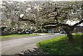
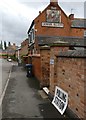
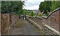
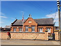
Photos of Willoughby Waterleys
Area Information
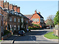
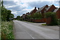
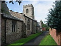
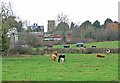
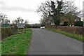
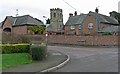
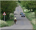
Living in Willoughby Waterleys offers a distinct experience within a defined civil parish covering 4.7 square kilometres. This compact area presents itself as a settled community where residents enjoy a high degree of independence. You will find the environment suited to those who value ownership, rather than those seeking a transient rental lifestyle. The geography is straightforward, without the complex planning constraints or protected statuses that often limit development in other parts of the county. Specifically, there are no Ramsar wetland sites, areas of outstanding natural beauty, protected nature reserves, or designated protected woodland within these boundaries. This clarity regarding land use means the character of the village remains stable and predictable. Daily life here centres on local familiarity and established routines rather than rapid urban expansion. The area functions as a self-contained parish where the scale of 4.7 km² ensures you can navigate spaces without extensive daily commutes across sprawling municipalities. While specific named local shops or landmarks are not detailed in the current records, the lack of major planning restrictions suggests a quiet, unthreatened atmosphere. You gain a property that stands outside of intricate conservation overlays. The community feel is reinforced by a population where long-term attachment to the land is the norm. Home ownership rates reflect this deep-rooted connection, indicating that the people here are likely to be settled families or individuals invested in the locality. When you consider homes in Willoughby Waterleys, you find a market driven by permanence. The absence of environmental red flags removes a layer of anxiety often associated with buying in more sensitive rural zones. This creates a straightforward decision-making process for prospective buyers who wish to establish a foothold. The area does not rely on fleeting trends or speculative investment; it relies on its solid demographic foundations. Living here means accepting a pace of life that matches the available space. It is a choice for stability, where the physical boundaries of the parish align with a desire for a secure, unchanging neighbourhood.
- Area Type
- Parish
- Area Size
- 4.7 km²
- Population
- Not available
- Population Density
- Not available
Demographics
The community in Willoughby Waterleys is remarkably age-balanced, with a median age of 70 years. This figure tells you that the area is primarily inhabited by senior residents who have likely lived here for many years. Most people in this age bracket fall into the broad "Age: Total" category, indicating a consistent population spread rather than a transient workforce. You are looking at a neighbourhood where you will meet neighbours who have deep local knowledge and established routines. This demographic profile often correlates with lower crime rates, which aligns with the assessment showing an 86 out of 100 safety score for the area. Home ownership stands at an impressive 84 per cent within Willoughby Waterleys. This statistic confirms that the vast majority of residents are owners rather than tenants. Such a high proportion of owners typically reduces turnover rates and fosters a sense of stewardship over the local environment. You will rarely encounter a speculative tenant culture here; instead, you find households committed to maintaining their properties. The accommodation mix reflects a stable housing stock designed for permanent residents, though specific breakdowns into bungalows or terraced houses are not detailed in the current figures. Ethnic diversity and religious affiliation are recorded as total categories in the available data. This suggests a homogenous community in terms of recorded background, which often contributes to a close-knit social fabric. There are no indications of significant deprivation or income stress in the provided datasets, allowing you to focus on the lifestyle benefits. The household composition data reinforces the idea of settled family units or couples living independently. You can approach life here with the confidence that you are moving into an area where financial stability is the norm, as evidenced by the lack of hardship indicators. It is a place where residents have put down roots, both financially and socially.
Household Size
Accommodation Type
Tenure
Ethnic Group
Religion
Household Composition
Age
Household Deprivation
NS-SEC
Explore more demographic insights in this area
Go to Demographics tabPlanning
Planning Constraints
- Flood RiskPremium
- Ramsar Wetland SitesPremium
- Area of Outstanding Natural BeautyPremium
- Protected Nature ReservePremium
- Protected WoodlandPremium
- Crime RiskPremium