Area Overview for Wigston Fields Ward
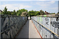
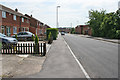
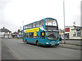
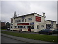
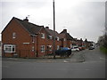
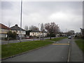
Photos of Wigston Fields Ward
Area Information
Living in Wigston Fields Ward offers a specific context within the broader Leicester urban area. This district council ward sits within Oadby and Wigston Borough Council, positioned south-east of Leicester city centre. You will find yourself at approximately 52.5898°N, -1.1187°W, forming part of the geographic fabric alongside the towns of Oadby and Wigston. The land itself is compact, covering just 1.5 km² of space. Despite this small footprint, the ward hosts a population of 1,585 residents. This results in a population density of 1,024 people per km², creating a relatively close-knit neighbourhood feel compared to sprawling suburban zones. The area functions as a residential component of a larger local government district with borough status. Daily life here is defined by proximity to the established towns and the central city looming to the north-west. The community is established, with a significant portion of residents having long-term roots. You are buying or living in a space where the size of the ward defines the scope of the immediate community. Homeownership rates drive the character of the street life, while the density ensures you are never truly isolated. The ward remains an integrated part of the East Midlands region, providing convenient access to wider city amenities while maintaining its own distinct administrative identity within Leicestershire.
- Area Type
- District Borough Unitary Ward
- Area Size
- 1.5 km²
- Population
- 1585
- Population Density
- 1024 people/km²
Demographics
The community within Wigston Fields Ward is defined by an older profile, with a median age of 70 years. This statistic indicates that the area is mature, and you will likely encounter a population with significant retirement needs or established families. The household composition data labels the total mix without specifying single-person households versus families, suggesting a diverse range of living arrangements. Seventy-three per cent of residents are homeowners, marking this as a predominantly owner-occupied sector. This high figure suggests stability, with many residents having purchased their properties over many years. Diversity metrics in the ward are reported for the total population without breaking down specific ethnic groups or religious affiliations. The demographic makeup is traditional, focused heavily on the older adult population. For planners and potential buyers, this means the local services and social groups may cater specifically to the needs of senior citizens. The high home ownership rate of 73% contrasts with urban areas where rental markets often dominate. You are entering a market where stability is the norm. The population density of over one thousand people per square kilometre ensures that despite the older age profile, the area retains a residential vigour.
Household Size
Accommodation Type
Tenure
Ethnic Group
Religion
Household Composition
Age
Household Deprivation
NS-SEC
Explore more demographic insights in this area
Go to Demographics tabPlanning
Planning Constraints
- Flood RiskPremium
- Ramsar Wetland SitesPremium
- Area of Outstanding Natural BeautyPremium
- Protected Nature ReservePremium
- Protected WoodlandPremium
- Crime RiskPremium