Area Overview for Wicksteed Ward
Photos of Wicksteed Ward
Area Information
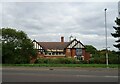
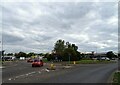
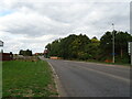
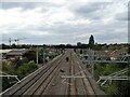
Wicksteed Ward is a small electoral ward located within Kettering Borough Council in North Northamptonshire. It sits in the East Midlands region of England and forms part of the wider Kettering parliamentary constituency. The locality covers exactly 5.4 square kilometres, providing a defined home territory for its residents. You might notice this ward has undergone significant administrative evolution. It was created through boundary changes in 2007, which merged with St Michael's to form the current St Michael's and Wicksteed ward before upcoming periods. Historically, this area functioned as a standalone two-member ward. Traditional political analysis regards this specific location as a Labour safe seat at the borough council level. Living in Wicksteed Ward means residing in an area with a very specific governance history. The physical footprint is compact, yet it holds distinct local character within the North Northants landscape. Your daily life here is shaped by these clear boundaries and the legacy of its formation over the last decade. The ward represents a settled community within the larger Kettering region.
- Area Type
- District Borough Unitary Ward
- Area Size
- 5.4 km²
- Population
- Not available
- Population Density
- Not available
Demographics
The community within Wicksteed Ward presents a notable demographic profile that differs from many other urban or suburban areas. The median age for residents sits high at 70 years old. This indicates a population comprised largely of older occupants who have likely down-sized or live in retirement-style accommodations. You are entering an area where age is a defining characteristic of daily life. The most common age range recorded encompasses the total population count rather than isolating specific younger cohorts. Home ownership is firmly established as the dominant mode of housing tenure. Figures show that 68% of residents own their homes outright or with a mortgage. This high ownership rate suggests strong local stability and long-term settling. The ward does not show data for predominant ethnic group, religion, or detailed household composition breakdowns in the available records. Consequently, you cannot assume specific diversity metrics without further research. The population structure points toward a quieter, potentially quieter lifestyle compared to younger, family-heavy neighbourhoods. Your proximity to this age group defines the social rhythm of Wicksteed Ward.
Household Size
Accommodation Type
Tenure
Ethnic Group
Religion
Household Composition
Age
Household Deprivation
NS-SEC
Explore more demographic insights in this area
Go to Demographics tabPlanning
Planning Constraints
- Flood RiskPremium
- Ramsar Wetland SitesPremium
- Area of Outstanding Natural BeautyPremium
- Protected Nature ReservePremium
- Protected WoodlandPremium
- Crime RiskPremium