Area Overview for Whittlebury
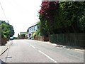
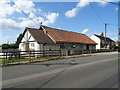
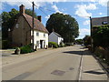
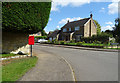
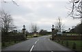
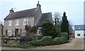
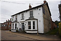
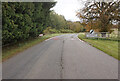
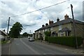
Photos of Whittlebury


Area Information
Whittlebury is a compact built-up area in England, spanning 33 hectares. Its small size means residents have easy access to local amenities and services, fostering a close-knit community feel. The area’s median age of 70 suggests a population skewed towards older adults, which may influence the pace of daily life and the types of services available. Living in Whittlebury offers a quiet, low-density environment, ideal for those seeking a slower rhythm of life. With 77% of homes owned outright, the area is predominantly owner-occupied, indicating long-term residency and stability. Nearby, Whittlebury Church of England Primary School provides a solid foundation for local families, while nearby retail outlets like Budgens Paulerspury and M&S Northampton BP offer essential shopping. The presence of Turweston Airport adds to the area’s connectivity, though it remains a minor feature in daily life. For buyers, Whittlebury presents a mix of practicality and tranquillity, with a focus on accessibility and community cohesion.
- Area Type
- Built Up Area 250
- Area Size
- 33.0 hectares
- Population
- Not available
- Population Density
- Not available
Whittlebury’s lifestyle is shaped by its proximity to retail and leisure options. Nearby, Budgens Paulerspury, M&S Northampton BP, and Waitrose Towcester provide a range of shopping experiences, from everyday essentials to premium grocery needs. These venues are within practical reach, enhancing convenience for residents. The area’s small size means local amenities are easily accessible, reducing the need for long commutes. While parks and recreational facilities are not specified in the data, the presence of retail and an airport suggests a balance between practicality and limited leisure options. For those valuing proximity to shopping and light travel, Whittlebury offers a functional lifestyle with a focus on accessibility.
Amenities
Schools
Whittlebury Church of England Primary School is the only named school listed in the data, serving the local community. It is a primary school with an Ofsted rating of ‘good,’ indicating a satisfactory standard of education. The absence of secondary schools or other educational institutions in the data means families may need to look beyond Whittlebury for secondary schooling. For primary education, the school’s rating provides a baseline of quality, though parents should consider additional factors like catchment areas and school capacity. The single school listed reflects the area’s small size, which may limit educational choices but ensures a close-knit school environment.
| Rank | School | Type | Entry gender | Ages |
|---|
Explore more schools in this area
Go to Schools tabDemographics
Whittlebury’s population has a median age of 70, reflecting a community where older adults form a significant proportion. This age profile may influence local services, with a focus on healthcare and leisure tailored to mature residents. The area’s home ownership rate of 77% indicates a strong presence of long-term residents, which can contribute to a stable and familiar neighbourhood environment. Accommodation types and household compositions are not specified in the data, but the overall demographic suggests a mix of single-person households and couples. The lack of specific diversity metrics means the area’s cultural and ethnic composition remains undefined in the provided statistics. For those considering relocation, the age demographic and ownership figures suggest a mature, settled community with fewer transient populations.
Household Size
Accommodation Type
Tenure
Ethnic Group
Religion
Household Composition
Age
Household Deprivation
NS-SEC
Explore more demographic insights in this area
Go to Demographics tabPlanning
Planning Constraints
- Crime RiskPremium