Area Overview for Whissendine
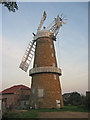
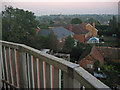
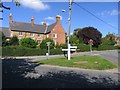
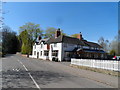
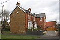
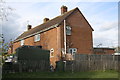
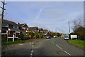
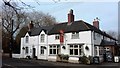
Photos of Whissendine


Area Information
Living in Whissendine offers a compact, well-defined community nestled in central England. Covering 54.8 hectares, the area is small enough to feel intimate yet functional for daily needs. With a median age of 70, it is a place where older residents form the majority, suggesting a mature, stable population. Home ownership here is high, at 80%, indicating a strong sense of local attachment. The area’s proximity to nearby towns like Oakham and Melton Mowbray ensures access to amenities without the need for long commutes. A Whissendine resident can walk or cycle to shops, rail stations, and even an airport within a short distance. The presence of a highly rated primary school adds to its appeal for families. While the population is older, the area remains active, with retail options like Aldi, Lidl, and M&S within reach. For those who value safety and convenience, Whissendine balances quiet living with practical connectivity.
- Area Type
- Built Up Area 250
- Area Size
- 54.8 hectares
- Population
- Not available
- Population Density
- Not available
Whissendine’s lifestyle is shaped by its proximity to essential amenities. Within walking or short driving distance are five retail outlets, including Aldi Oakham, M&S Oakham BP, and Lidl Oakham, offering everyday shopping needs. The area’s rail stations at Oakham and Melton Mowbray provide easy access to nearby towns, while RAF Cottesmore airport adds convenience for travel. For leisure, the compact size of Whissendine means residents can reach these amenities without long journeys, fostering a sense of self-sufficiency. The presence of a primary school and nearby shops suggests a community focused on practicality and accessibility. While the data does not mention parks or recreational spaces, the combination of retail, transport, and travel options indicates a lifestyle that prioritises convenience and connectivity.
Amenities
Schools
Whissendine Church of England Primary School is the only school explicitly listed in the data, serving the local community. As a primary school, it caters to children aged 4–11, providing education for younger families in the area. The school holds an Ofsted rating of “outstanding,” a strong indicator of quality teaching and facilities. While no secondary schools are mentioned, the presence of a highly rated primary school suggests that families with young children may find the area suitable for their needs. However, the absence of secondary education options within Whissendine itself could require students to travel to nearby towns for further schooling. The single school listed reflects the area’s small size, where educational provision is limited but focused on core needs.
| Rank | School | Type | Entry gender | Ages |
|---|
Explore more schools in this area
Go to Schools tabDemographics
Whissendine’s demographic profile is defined by its median age of 70, the highest in the dataset, suggesting a community where older residents dominate. The most common age range is listed as “Total,” which may reflect aggregated data rather than specific groups. Home ownership is robust, with 80% of households owning their homes, a figure that often correlates with long-term residency and community stability. The data does not specify household composition or accommodation types, but the high ownership rate implies a mix of family homes and larger properties suited to older demographics. The area’s population appears less diverse in terms of ethnicity and religion, though exact figures are not provided. This demographic structure means services and amenities are likely tailored to older residents, with a focus on accessibility and low-maintenance living.
Household Size
Accommodation Type
Tenure
Ethnic Group
Religion
Household Composition
Age
Household Deprivation
NS-SEC
Explore more demographic insights in this area
Go to Demographics tabPlanning
Planning Constraints
- Crime RiskPremium