Area Overview for Westrill and Starmore
Photos of Westrill and Starmore

Area Information
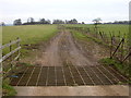
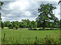
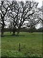
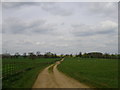
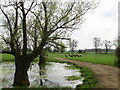
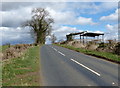
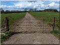
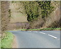
Westrill and Starmore is a small civil parish in England, covering an area of just 5.9 km². Living in Westrill and Starmore offers a defined, contained environment where the boundaries of daily life are clear. The parish exists as a distinct administrative unit, providing a stable framework for residents within Yorkshire. You move here with a specific understanding of the locality's scale and administrative status. The name Westrill and Starmore appears twice in official records when you search for homes in this specific parish. Your daily life centres on a compact space where the community feels manageable. The area functions as a residential pocket between larger towns, offering a quiet节奏 without the anonymity of a major city council district. When you consider living in Westrill and Starmore, you are choosing a location with a clear identity. The 5.9 km² footprint ensures you know your neighbours and the limits of your journey. Local institutions and services operate within this fixed geographic boundary. You do not need to venture far to understand the character of the parish. The environment presents itself as a traditional settlement where the scale remains consistent for visitors and new residents. Homes in Westrill and Starmore sit within a recognised civil parish structure in England. This administrative detail matters when you check local governance or service provision. You find that the area maintains its designation as a parish throughout county boundaries. The consistency of the name Westrill and Starmore in official documents reinforces its established status. Your exploration of the area begins with these fundamental facts about its size and classification. The neighbourhood offers a straightforward layout defined by its small extent. You can navigate the parish directly without the confusion of fragmented administrative zones.
- Area Type
- Parish
- Area Size
- 5.9 km²
- Population
- Not available
- Population Density
- Not available
Demographics
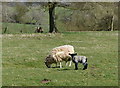
The community in Westrill and Starmore reflects a mature settlement with a median age of 70. Living in Westrill and Starmore means you neighbour a population that has settled over decades. Eighty per cent of households own their homes, creating a dense fabric of owner-occupiers. This high level of home ownership reshapes the social rhythm of the parish. You find that most residents have lived in their current addresses for a significant period. The demographic profile indicates a place where families have stayed and grown old together. The age distribution shows the oldest group dominates the total population count. This statistic shapes the local demand for specific services and recreational facilities. When you walk through Westrill and Starmore, you encounter a community with a distinct generational focus. The household composition data confirms that private ownership remains the standard living arrangement. You do not encounter a high density of private rentals compared to younger urban areas. The stability of the 80% ownership rate suggests strong local attachment to specific properties. Accommodation types in the parish follow this pattern of long-term residence. You find that the housing stock supports an older, settled demographic. The data paints a clear picture of who lives here without obscure qualifiers. The community feels cohesive because so many residents hold the same keys to their homes. You can expect a neighbourhood where change happens slowly within the bounds of established households. The age factor of 70 years old stands as a central pillar of the area's identity. This demographic reality influences everything from local shop inventories to transport schedules. When you consider the social landscape of Westrill and Starmore, you see a space defined by endurance. The residents here value the security of tenure that comes with high ownership rates. You move into a place where the majority have built their lives locally. The statistic of 80% ownership contrasts sharply with transient urban hubs. The community feels rooted, with people knowing their history within the parish boundaries. The age profile remains your primary indicator of the daily life you will join. Westrill and Starmore offers a demographic environment focused on stability and longevity.
Household Size
Accommodation Type
Tenure
Ethnic Group
Religion
Household Composition
Age
Household Deprivation
NS-SEC
Explore more demographic insights in this area
Go to Demographics tabPlanning
Planning Constraints
- Flood RiskLocked
- Ramsar Wetland SitesLocked
- Area of Outstanding Natural BeautyLocked
- Protected Nature ReserveLocked
- Protected WoodlandLocked
- Crime RiskLocked