Area Overview for Weston Hills
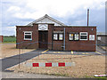
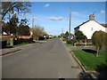
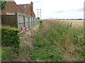
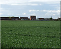
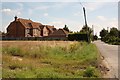
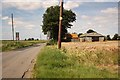
Photos of Weston Hills


Area Information
Weston Hills is a compact built-up area in England, spanning 25.6 hectares. Its population profile suggests a community skewed toward older residents, with a median age of 70. This hints at a settled, perhaps retired demographic, though the data does not specify household types or ethnic diversity. The area’s small size implies a close-knit environment, with amenities and services clustered within practical reach. Safety is a notable feature: the crime risk score of 85/100 indicates below-average crime rates, offering reassurance for residents. Nearby, the Spalding Railway Station provides rail access, while retail outlets like Tesco Spalding, Iceland Spalding, and Heron Spalding cater to daily needs. For those prioritising convenience, the proximity of these amenities and the low crime risk make Weston Hills a viable option for buyers seeking a quiet, secure neighbourhood with essential services nearby.
- Area Type
- Built Up Area 250
- Area Size
- 25.6 hectares
- Population
- Not available
- Population Density
- Not available
The lifestyle in Weston Hills is shaped by its proximity to practical amenities. Within walking or short driving distance are five retail outlets, including major stores like Tesco Spalding, Iceland Spalding, and Heron Spalding, offering a range of shopping options. The Spalding Railway Station provides access to rail services, which is valuable for those needing to commute or travel regionally. While the data does not mention parks or leisure facilities, the compact nature of the area suggests that daily life is centred around these core services. The combination of retail, transport, and a low crime risk creates a functional environment for those prioritising convenience and safety over expansive recreational spaces.
Amenities
Schools
The primary school nearest to Weston Hills is Weston Hills CofE Primary School, which has an Ofsted rating of 'good'. This school serves the local community and is likely a key consideration for families with young children. The absence of secondary schools in the data means that families may need to look further afield for secondary education, but the primary school’s rating suggests a solid foundation for early learning. The presence of a single primary school in the area indicates that it is the main educational hub for younger residents, though the data does not provide information on school capacity or pupil numbers.
| Rank | A + A* % | School | Type | Entry gender | Ages |
|---|---|---|---|---|---|
| 1 | N/A | Weston Hills CofE Primary School | primary | N/A | N/A |
Explore more schools in this area
Go to Schools tabDemographics
The population of Weston Hills has a median age of 70, placing it well above the national average, which suggests a community dominated by older adults. Home ownership is high at 82%, indicating a stable, long-term resident base with fewer renters. The data does not specify household composition, accommodation types, or ethnic diversity, so these aspects remain unquantified. However, the high home ownership rate implies a lower turnover of properties, which can contribute to a sense of continuity in the area. The absence of detailed demographic breakdowns means that while the age profile is clear, other factors such as family structures or cultural diversity are not defined by the available data.
Household Size
Accommodation Type
Tenure
Ethnic Group
Religion
Household Composition
Age
Household Deprivation
NS-SEC
Explore more demographic insights in this area
Go to Demographics tabPlanning
Planning Constraints
- Crime RiskLocked