Area Overview for Weston By Welland
Photos of Weston By Welland


Area Information
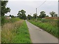
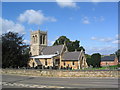
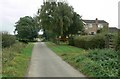
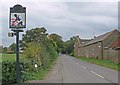
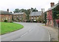
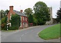
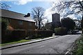
Weston By Welland is a small civil parish located in England, covering a total area of 4.2 square kilometres. Living in Weston By Welland feels distinctly different from larger towns due to the limited landmass, which creates an intimate community environment. The area represents a specific slice of the English countryside where residents enjoy a quiet, settled lifestyle without the density of urban centres. You are looking at a neighbourhood defined by its compact footprint, which means everything from local shops to green spaces is within a short walk or drive for most households. The distinctive character of Weston By Welland stems from its status as a parish, a term that often implies a strong sense of local governance and community spirit. While the physical size is modest at just over four square kilometres, this does not detract from the quality of life. Instead, it focuses residential life into a manageable zone where neighbours know one another. Prospective buyers seeking a tranquil setting will find that Weston By Welland offers exactly that, with no overshadowing distractions from major cities. Daily life here revolves around the immediate surroundings of the parish boundaries. You do not need to look far for local amenities, though the small scale means many daily trips may involve a car or bicycle. The environment is designed for residents who value peace and stability over the relentless pace of metropolitan living. This compact nature ensures that Weston By Welland remains a cohesive community where the pace of life allows you to step outside your door and feel connected to the immediate world around your home. It is an area where the boundaries of your daily routine remain tightly controlled by the geography of the parish itself.
- Area Type
- Parish
- Area Size
- 4.2 km²
- Population
- Not available
- Population Density
- Not available
Demographics
The community in Weston By Welland shows a clear demographic profile shaped by its rural location and housing stock. A significant majority of residents are older adults, with the median age standing at 70 years old. This high median age suggests that Weston By Welland is primarily a retirement haven or a desirable location for those enjoying their later years. The most common age grouping reflects this trend, indicating that families with young children are less prevalent compared to older couples or individuals living independently. You can expect a neighbourhood where age is not a barrier but rather a shared characteristic among many neighbours. Home ownership levels in Weston By Welland are exceptionally high, reaching 81 percent of the total population. This figure indicates that the vast majority of people living in Weston By Welland own their homes outright or have a mortgage, rather than renting. Such a high ownership rate often correlates with a wealthy or stable population that has made firm investments in the local property market. The low presence of private rentals means that the tenant market is minimal, and most households enjoy the security of owning their property. Household composition further supports this picture of an established community. The data shows that accommodation types across the parish align with this owner-occupied majority. Diversity in terms of ethnicity and religion is not detailed in the available breakdowns, meaning the population likely reflects a homogeneous group typical of certain rural parishes. You are joining a community where residents have put down deep roots, leading to a stable social fabric where long-term neighbours support one another through the seasons.
Household Size
Accommodation Type
Tenure
Ethnic Group
Religion
Household Composition
Age
Household Deprivation
NS-SEC
Explore more demographic insights in this area
Go to Demographics tabPlanning
Planning Constraints
- Flood RiskPremium
- Ramsar Wetland SitesPremium
- Area of Outstanding Natural BeautyPremium
- Protected Nature ReservePremium
- Protected WoodlandPremium