Area Overview for Western Ward
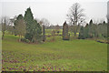
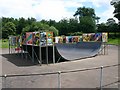
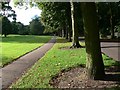
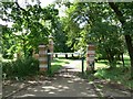
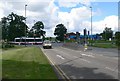
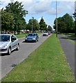
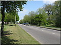
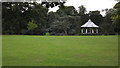
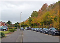
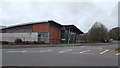
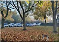
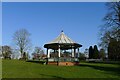
Photos of Western Ward
Area Information
You are looking at Western Ward, a compact district within Nottingham that covers exactly 5.8 square kilometres. This small borough unitary ward contains a population of 1,915 residents, creating a modest community focused on local amenities rather than high-density urban sprawl. Living in this area means experiencing neighbourhoods defined by significant green spaces rather than towering city blocks. The ward adjoins notable features such as Wollaton Park, Highfields Park, and the University of Nottingham, shaping a distinct character for those buying homes here. Residents enjoy a location southwest of the city centre, bordered by areas including Beechdale, Bilborough, and Lenton Abbey. The population density stands at 331 people per square kilometre, offering a balance between connectivity and room to breathe. This setting suits individuals and couples who prioritise access to established daily life conveniences while remaining close to major educational and recreational destinations. The area functions as a self-contained community where the proximity to the university and extensive parklands influences the rhythm of daily life. You will find that life here revolves around these specific geographical markers, offering a quieter alternative to immediate city centre living without being isolated from the region's main hubs. The combination of limited land area and substantial green infrastructure makes Western Ward unique among neighbouring electoral wards in the East Midlands. The community in Western Ward exhibits a distinctly older demographic profile compared to many other urban areas. Residents here have a median age of 70 years, which reflects a population heavily skewed towards older adults. Half of all voters in the area fall into the category where age data is recorded as 'Total', indicating a significant proportion of the electorate consists of seniors. This age distribution suggests a neighbourhood where residents are likely retired or approaching retirement, influencing local services and social activities. Home ownership stands at exactly 50 per cent, meaning half of the households in the ward either rent or own their properties outright. This split indicates a balanced market where ownership is neither universal nor rare. The ward does not provide specific data on predominant ethnic groups, religion, or detailed household composition breakdowns in this summary, so demographic analysis relies heavily on the age and ownership figures available. You should expect a community where age-specific events, calendar clubs, and health services for the elderly dominate the local calendar. The high median age implies that families with young children may find fewer peers than in other parts of Nottingham, while retirees may appreciate the quieter, less frenetic atmosphere. Understanding these demographics helps you visualise the daily interactions and community spirit you would experience when moving into a home in this specific ward. Homes in Western Ward operate within a market defined primarily by the home ownership statistic of 50 per cent. This figure shapes the type of inventory available to prospective buyers and renters alike. A half ownership rate suggests a steady mix of owner-occupied семейs and private landlords, though specific data on rental versus mortgage statistics is not detailed in this profile. The presence of significant green spaces like Wollaton Park and Highfields Park likely influences property values and desirability for buyers seeking proximity to nature. The ward's small area size of 5.8 square kilometres and population of 1,915 indicate a tightly knit housing pool where each property contributes noticeably to the local market dynamics. While the data does not explicitly list average sale prices or rental yields, the 50 per cent ownership level implies established stability alongside potential availability for first-time movers or those upgrading from smaller units. The accommodation type data is aggregated as 'total', meaning specific breakdowns of detached, semi-detached, or terraced housing are not separately enumerated here. However, the ward's character, bordered by Beechdale and adjacent to the University of Nottingham, suggests a mix of large family homes near the park and perhaps some student-facing or conversion properties. Buyers should recognise that with half the population owning their homes, council tax bands and maintenance responsibilities may affect the financial planning required for this specific area. Digital connectivity in Western Ward is excellent, with a fixed broadband quality score of 100 out of 100. This perfect rating means you can expect internet speeds and reliability comparable to the best available infrastructure anywhere in the country. For anyone planning to work from home or stream high-definition content, the network performance here will not be a constraint. The high score indicates strong coverage for both fixed line connections and the mobile infrastructure required to run modern smart devices efficiently. Living in this area, you will find that your digital life is fully supported without the lag or buffering issues often found in older parts of the city. This level of connectivity enhances the convenience of remote working, which is increasingly important for residents balancing their time between the local ward and broader opportunities in Nottingham. The excellent broadband score complements the ward's physical connectivity, which is supported by its location near the University of Nottingham and major parks. You do not need to compromise on high-speed internet access when choosing a property here. The combination of a perfect broadband score and the ward's proximity to transport hubs ensures that daily communication and data needs are met with the reliability modern technology demands. This technical foundation provides peace of mind for those settling into homes in Western Ward. Safety in Western Ward presents a clear picture when examining environmental assessments and crime metrics. The ward passes all major planning constraint assessments regarding flood risk, Ramsar wetland sites, Areas of Outstanding Natural Beauty, protected nature reserves, and protected woodland. Specifically, the flood risk score is 1.12 out of 100, indicating very low flood risk coverage for properties in this area. You can move forward with confidence that your home will not face waterlogging or structural threats from rising water levels. The absence of Ramsar sites, AONB, or protected woodlands means there are no major planning constraints that could hinder future extensions or developments. However, the crime risk assessment reveals a warning level with a score of 43 out of 100. This medium crime risk suggests that crime rates are around the national average, requiring standard security precautions such as locks, alarms, and vigilance after dark. While reassured by the environmental safety scores, you must remain aware that standard urban caution is advisable when walking home in the evenings. The score indicates no extreme danger, but it does not imply a crime-free zone. Residents should balance the knowledge of low environmental hazards with the practical need for basic home security measures. This balanced view helps you weigh the tranquility of living near Wollaton Park against the standard safety protocols required in any suburban district of Nottingham. What is the community like for someone moving to Western Ward? The community in Western Ward is quiet and age-focused, with a median resident age of 70 years. Half of the households own their homes, suggesting a stable, established population rather than a transient area. The ward's small size of 5.8 square kilometres means neighbourly interactions are likely regular within the close-knit neighbourhoods surrounding Wollaton Park. Is the area safe and are there planning restrictions on building? You will find low environmental risks, as the area has a flood risk score of just 1.12 and no protected status for wetlands or woodlands. However, the crime risk assessment shows a medium level with a score of 43, meaning standard security precautions are necessary. Planning is straightforward since there are no AONB or nature reserve constraints affecting the land. How good is the internet connection for working from home? Digital connectivity is excellent across the ward. The fixed broadband quality score is a perfect 100, ensuring reliable high-speed internet for remote work or streaming. This top-tier performance means you can count on consistent connectivity regardless of your specific street location within the 5.8 square kilometre boundary. Who typically lives in this ward and what are the demographics? The population of 1,915 residents has a distinctly older profile, with a median age of 70 years. Home ownership stands at exactly 50 per cent, balancing tenants and owners. The ward lacks specific data on ethnicity or religion but the age profile points to a retirement demographic rather than young families or students.
- Area Type
- District Borough Unitary Ward
- Area Size
- 5.8 km²
- Population
- 1915
- Population Density
- 331 people/km²
Demographics
The community in Western Ward exhibits a distinctly older demographic profile compared to many other urban areas. Residents here have a median age of 70 years, which reflects a population heavily skewed towards older adults. Half of all voters in the area fall into the category where age data is recorded as 'Total', indicating a significant proportion of the electorate consists of seniors. This age distribution suggests a neighbourhood where residents are likely retired or approaching retirement, influencing local services and social activities. Home ownership stands at exactly 50 per cent, meaning half of the households in the ward either rent or own their properties outright. This split indicates a balanced market where ownership is neither universal nor rare. The ward does not provide specific data on predominant ethnic groups, religion, or detailed household composition breakdowns in this summary, so demographic analysis relies heavily on the age and ownership figures available. You should expect a community where age-specific events, calendar clubs, and health services for the elderly dominate the local calendar. The high median age implies that families with young children may find fewer peers than in other parts of Nottingham, while retirees may appreciate the quieter, less frenetic atmosphere. Understanding these demographics helps you visualise the daily interactions and community spirit you would experience when moving into a home in this specific ward. Homes in Western Ward operate within a market defined primarily by the home ownership statistic of 50 per cent. This figure shapes the type of inventory available to prospective buyers and renters alike. A half ownership rate suggests a steady mix of owner-occupied семейs and private landlords, though specific data on rental versus mortgage statistics is not detailed in this profile. The presence of significant green spaces like Wollaton Park and Highfields Park likely influences property values and desirability for buyers seeking proximity to nature. The ward's small area size of 5.8 square kilometres and population of 1,915 indicate a tightly knit housing pool where each property contributes noticeably to the local market dynamics. While the data does not explicitly list average sale prices or rental yields, the 50 per cent ownership level implies established stability alongside potential availability for first-time movers or those upgrading from smaller units. The accommodation type data is aggregated as 'total', meaning specific breakdowns of detached, semi-detached, or terraced housing are not separately enumerated here. However, the ward's character, bordered by Beechdale and adjacent to the University of Nottingham, suggests a mix of large family homes near the park and perhaps some student-facing or conversion properties. Buyers should recognise that with half the population owning their homes, council tax bands and maintenance responsibilities may affect the financial planning required for this specific area. Digital connectivity in Western Ward is excellent, with a fixed broadband quality score of 100 out of 100. This perfect rating means you can expect internet speeds and reliability comparable to the best available infrastructure anywhere in the country. For anyone planning to work from home or stream high-definition content, the network performance here will not be a constraint. The high score indicates strong coverage for both fixed line connections and the mobile infrastructure required to run modern smart devices efficiently. Living in this area, you will find that your digital life is fully supported without the lag or buffering issues often found in older parts of the city. This level of connectivity enhances the convenience of remote working, which is increasingly important for residents balancing their time between the local ward and broader opportunities in Nottingham. The excellent broadband score complements the ward's physical connectivity, which is supported by its location near the University of Nottingham and major parks. You do not need to compromise on high-speed internet access when choosing a property here. The combination of a perfect broadband score and the ward's proximity to transport hubs ensures that daily communication and data needs are met with the reliability modern technology demands. This technical foundation provides peace of mind for those settling into homes in Western Ward. Safety in Western Ward presents a clear picture when examining environmental assessments and crime metrics. The ward passes all major planning constraint assessments regarding flood risk, Ramsar wetland sites, Areas of Outstanding Natural Beauty, protected nature reserves, and protected woodland. Specifically, the flood risk score is 1.12 out of 100, indicating very low flood risk coverage for properties in this area. You can move forward with confidence that your home will not face waterlogging or structural threats from rising water levels. The absence of Ramsar sites, AONB, or protected woodlands means there are no major planning constraints that could hinder future extensions or developments. However, the crime risk assessment reveals a warning level with a score of 43 out of 100. This medium crime risk suggests that crime rates are around the national average, requiring standard security precautions such as locks, alarms, and vigilance after dark. While reassured by the environmental safety scores, you must remain aware that standard urban caution is advisable when walking home in the evenings. The score indicates no extreme danger, but it does not imply a crime-free zone. Residents should balance the knowledge of low environmental hazards with the practical need for basic home security measures. This balanced view helps you weigh the tranquility of living near Wollaton Park against the standard safety protocols required in any suburban district of Nottingham. What is the community like for someone moving to Western Ward? The community in Western Ward is quiet and age-focused, with a median resident age of 70 years. Half of the households own their homes, suggesting a stable, established population rather than a transient area. The ward's small size of 5.8 square kilometres means neighbourly interactions are likely regular within the close-knit neighbourhoods surrounding Wollaton Park. Is the area safe and are there planning restrictions on building? You will find low environmental risks, as the area has a flood risk score of just 1.12 and no protected status for wetlands or woodlands. However, the crime risk assessment shows a medium level with a score of 43, meaning standard security precautions are necessary. Planning is straightforward since there are no AONB or nature reserve constraints affecting the land. How good is the internet connection for working from home? Digital connectivity is excellent across the ward. The fixed broadband quality score is a perfect 100, ensuring reliable high-speed internet for remote work or streaming. This top-tier performance means you can count on consistent connectivity regardless of your specific street location within the 5.8 square kilometre boundary. Who typically lives in this ward and what are the demographics? The population of 1,915 residents has a distinctly older profile, with a median age of 70 years. Home ownership stands at exactly 50 per cent, balancing tenants and owners. The ward lacks specific data on ethnicity or religion but the age profile points to a retirement demographic rather than young families or students.
Household Size
Accommodation Type
Tenure
Ethnic Group
Religion
Household Composition
Age
Household Deprivation
NS-SEC
Explore more demographic insights in this area
Go to Demographics tabPlanning
Planning Constraints
- Flood RiskPremium
- Ramsar Wetland SitesPremium
- Area of Outstanding Natural BeautyPremium
- Protected Nature ReservePremium
- Protected WoodlandPremium