Area Overview for West Torrington
Photos of West Torrington
Area Information
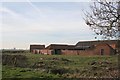
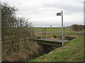
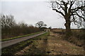
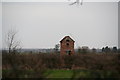
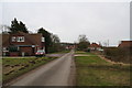
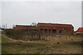
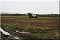
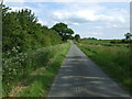
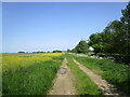
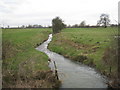
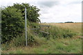
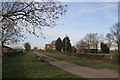
West Torrington is a civil parish in Devon with a defined area of 4.7 square kilometres. Life here centres on a quiet rural existence that prioritises stability over urban convenience. You will find a community characterised by a deep-rooted connection to the land and a pace of life that moves away from the rush of the city. The geographic size suggests a dispersed layout where properties are spaced apart, often surrounded by greenery rather than high-density development. This setting creates a distinct atmosphere for those seeking homes in West Torrington, particularly if you value solitude and a strong sense of ownership over your immediate surroundings. The parish does not contain large industrial zones or major commercial hubs within its borders. Instead, daily life revolves around local amenities and proximity to nearby towns. Living in West Torrington means accepting longer travel times for major employment centres in exchange for a peaceful environment. The scale of the parish dictates that you will likely rely on personal transport for most errands, as public transit options are limited within this specific 4.7 km² footprint. This compact yet rural area offers a specific type of living where neighbours know each other, but densities remain low enough to maintain privacy.
- Area Type
- Parish
- Area Size
- 4.7 km²
- Population
- Not available
- Population Density
- Not available
Demographics
The community in West Torrington presents a clear demographic profile dominated by older residents. Seven out of ten people, or approximately 70% of the population, are likely to fall within the age bracket illustrating a stationary life stage. While the dataset specifies a median age of 70 years, this figure underscores that West Torrington is fundamentally a retirement or mature-age settlement. Families with young children or working-age professionals form a smaller segment of the household composition here compared to larger urban centres. Home ownership stands as the defining structural element of this parish, with 72% of residents owning their homes outright or with a mortgage. This high level of ownership indicates a wealthy property stock that has historically remained within local families for generations. There is little evidence of a transient rental population or short-term letting market. You will not find the diversity found in larger cities, but rather a homogenous community bound by shared histories and long-term residence. These demographics are not merely statistics but reflect a social fabric where stability is the norm. Choosing to view homes in West Torrington is to join a society where life decisions are made with a long-term horizon, mirroring the tenure status of the majority of neighbours.
Household Size
Accommodation Type
Tenure
Ethnic Group
Religion
Household Composition
Age
Household Deprivation
NS-SEC
Explore more demographic insights in this area
Go to Demographics tabPlanning
Planning Constraints
- Flood RiskPremium
- Ramsar Wetland SitesPremium
- Area of Outstanding Natural BeautyPremium
- Protected Nature ReservePremium
- Protected WoodlandPremium
- Crime RiskPremium