Area Overview for West Hunsbury
Photos of West Hunsbury
Area Information
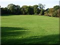
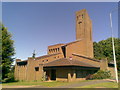
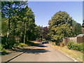
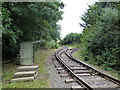
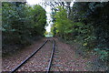
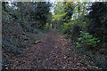
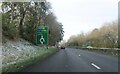
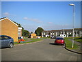
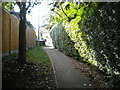
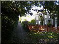
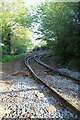
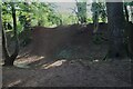
West Hunsbury is a distinct civil parish and residential estate located in the south of Northampton. The area covers 2.3 km² and sits approximately 2 miles from Northampton town centre. You are just 0.5 miles from the M1 motorway via junction 15A via the Mereway ring road. This proximity makes it a practical choice for commuters. The locality has a rich history, featuring the site of an Iron Age hill fort dating back to circa 400 BC. You can visit the demonstration railway and museum at Hunsbury Hill Country Park. West Hunsbury was de-parished during the 1980s but re-established as a civil parish on 1 April 2013 following a Community Governance Review. The area previously hosted the Hunsbury Ironworks, which operated from the early 1870s until 1921. Today, the parish council focuses on local services and improvements. Living in West Hunsbury means access to modern community facilities such as shops, a supermarket, and a health centre. You will also find a church and sheltered housing options on your doorstep. The environment includes the Grade II listed Hunsbury Hill Centre, a popular venue for community events built circa 1770. This setting combines historical depth with suburban convenience.
- Area Type
- Parish
- Area Size
- 2.3 km²
- Population
- Not available
- Population Density
- Not available
Demographics
You will find a community defined by its older profile within West Hunsbury. The median age for residents is 70 years. This figure indicates a population significantly older than the national average. Age: Total is the most common age range grouping provided for the area. Seventy-eight per cent of homes in West Hunsbury are owner-occupied. This high rate suggests a stable community where long-term residents have put down roots. The remaining 22% of households likely consist of private renters or other tenure types. The parish council focuses on local services and improvements for these residents. West Hunsbury forms part of the larger Hunsbury residential area but is governed independently. The council held its first elections on 2 May 2013 following the re-establishment of the civil parish. The area features suburban housing estates alongside the Hunsbury Hill Centre. While specific data on household composition or predominant ethnic groups is not separately detailed, the high home ownership rate reflects a traditional demographic structure. The presence of sheltered housing indicates consideration for those requiring additional support. You are living in an area where the community is settled and established, with a clear focus on local governance and historical preservation within the East Midlands.
Household Size
Accommodation Type
Tenure
Ethnic Group
Religion
Household Composition
Age
Household Deprivation
NS-SEC
Explore more demographic insights in this area
Go to Demographics tabPlanning
Planning Constraints
- Flood RiskPremium
- Ramsar Wetland SitesPremium
- Area of Outstanding Natural BeautyPremium
- Protected Nature ReservePremium
- Protected WoodlandPremium
- Crime RiskPremium