Area Overview for West Hallam
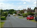
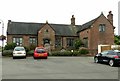
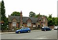
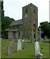
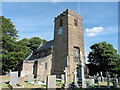
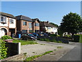
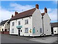
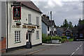
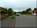
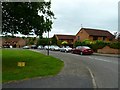
Photos of West Hallam


Area Information
West Hallam is a compact built-up area spanning 2.3 km², nestled in England’s heartlands. Its population, though not explicitly stated, is reflected in its mature demographic profile, with a median age of 70, suggesting a community skewed toward older residents. The area’s appeal lies in its blend of practicality and safety, with a home ownership rate of 82% indicating a strong presence of long-term residents. Daily life here is shaped by proximity to essential services, including multiple primary schools and a network of rail and tram connections. The low crime risk score of 83 makes it an attractive option for those prioritising security. While the area lacks the vibrancy of larger cities, its quiet, established character offers a calm alternative to busier urban centres. Residents benefit from reliable digital connectivity, with broadband scores near 100, ensuring seamless access to online services. For those seeking a stable, low-maintenance environment with accessible amenities, West Hallam provides a straightforward, no-frills living experience.
- Area Type
- Built Up Area 250
- Area Size
- 2.3 km²
- Population
- Not available
- Population Density
- Not available
The lifestyle in West Hallam is shaped by its accessible amenities. Residents have nearby supermarkets such as Tesco West, Asda Ladywood, and Co-op Summerfield, ensuring everyday shopping needs are met. The area’s transport links, including rail and tram stations, provide easy access to surrounding towns and cities. While parks or recreational spaces are not explicitly listed, the proximity to retail and transport hubs suggests a practical, community-focused lifestyle. The presence of multiple primary schools and a low crime risk score adds to the area’s appeal, offering families a balance of safety and convenience. For those prioritising ease of access over expansive leisure options, West Hallam delivers a straightforward, functional living environment.
Amenities
Schools
West Hallam is served by four primary schools, all affiliated with the Church of England. These include Stanley Common CofE Primary School, Scargill CofE (Aided) Primary School, Scargill CofE Primary School, and Stanley Common Church of England Primary School. One of these schools, Scargill CofE Primary School, holds an Ofsted rating of “good,” indicating a solid standard of education. The concentration of Church of England schools suggests a community with religious affiliations, though the data does not specify attendance rates or academic performance beyond the one rated school. For families, the availability of multiple primary schools within proximity offers flexibility, though the absence of secondary schools or specialist institutions means further research is needed for secondary education options.
| Rank | School | Type | Entry gender | Ages |
|---|
Explore more schools in this area
Go to Schools tabDemographics
West Hallam’s demographic profile is defined by its high median age of 70, with the majority of residents falling within the total age range. Home ownership is prevalent, with 82% of households owning their properties, suggesting a settled community with long-term residency patterns. The data does not specify household composition or accommodation types, but the high ownership rate implies a mix of family homes and single-occupancy properties. The area’s ethnic and religious diversity is not quantified, though the absence of specific figures means no conclusions can be drawn about cultural or social diversity. The lack of deprivation data means it is unclear how economic factors influence quality of life, but the overall stability of the area—reflected in its safety and connectivity—suggests a reasonably comfortable standard of living for its residents.
Household Size
Accommodation Type
Tenure
Ethnic Group
Religion
Household Composition
Age
Household Deprivation
NS-SEC
Explore more demographic insights in this area
Go to Demographics tabPlanning
Planning Constraints
- Crime RiskPremium