Area Overview for West Bridgford
Photos of West Bridgford

Area Information
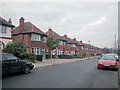
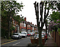
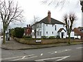
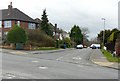
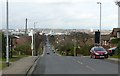
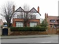
West Bridgford is a compact town in Nottinghamshire, covering 8.3 km² and home to 14,775 residents. Its population density of 1,774 people per square kilometre suggests a tightly knit community, though the area’s character is shaped by its mix of residential and retail spaces. The town sits within easy reach of Nottingham city centre, offering a balance of suburban tranquillity and urban convenience. Daily life here is defined by proximity to amenities, with multiple schools, transport links, and shopping options within walking or short driving distance. The median age of 70 indicates a community skewed toward older residents, which influences the local culture and services. For buyers, West Bridgford offers a blend of established housing stock and practical infrastructure, making it appealing to those seeking a settled lifestyle without sacrificing accessibility. Its tram and rail connections, combined with a strong broadband score, support both commuter needs and remote working. The area’s safety profile, with a low crime risk, further enhances its appeal for families and retirees alike.
- Area Type
- Built Up Area 250
- Area Size
- 8.3 km²
- Population
- 14775
- Population Density
- 1774 people/km²
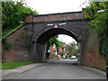
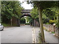
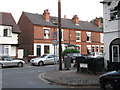
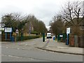
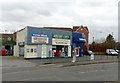
West Bridgford offers a range of amenities within practical reach, enhancing daily life for residents. Retail options include Sainsburys West Bridgford, Cook West, and Asda Nottingham, providing convenient shopping for essentials. The tram network, with stops like Wilford Lane and Ruddington Lane, connects residents to local and regional destinations. Rail services at Nottingham and Netherfield stations offer faster access to the city and beyond. The nearby Nottingham Airport adds to the area’s appeal for frequent travelers. Parks and recreational spaces are not explicitly detailed in the data, but the tram and rail stops suggest proximity to green spaces. The combination of retail, transport, and travel hubs creates a lifestyle that balances convenience with accessibility. Residents can enjoy a mix of urban and suburban comforts, with amenities supporting both daily needs and leisure activities.
Amenities
Schools
West Bridgford has five primary schools within its vicinity, all offering essential education for young families. Lady Bay Primary School, Jesse Gray Primary School, West Bridgford Infant School, and West Bridgford Junior School each hold a ‘good’ Ofsted rating, indicating strong performance and reliable standards. Abbey Road Primary School is also present but lacks an Ofsted rating in the data. The concentration of primary schools reduces the need for long commutes, supporting families who prioritise proximity to education. The mix of schools provides options for parents, though secondary education facilities are not detailed in the data. For buyers, the presence of multiple well-rated primary schools is a key consideration, especially for those planning to settle with children. The quality of these schools contributes to the area’s appeal as a family-friendly location.
| Rank | School | Type | Entry gender | Ages |
|---|
Explore more schools in this area
Go to Schools tabDemographics
West Bridgford’s population has a median age of 70, reflecting a community predominantly composed of older residents. This age profile shapes the local dynamic, with services and amenities tailored to this demographic. Home ownership is high, at 74%, suggesting a stable, long-term resident base. The data does not specify household types or ethnic diversity, but the ‘total’ category for these fields implies a broad mix. The area’s population density of 1,774 people per km² means residents live in close proximity, which can foster a sense of community. However, the lack of detailed breakdowns on deprivation or socioeconomic factors means it is difficult to assess how this density affects quality of life. The high median age may influence local infrastructure needs, such as healthcare access and leisure facilities. For prospective buyers, understanding the age profile is key to aligning property choices with the area’s character.
Household Size
Accommodation Type
Tenure
Ethnic Group
Religion
Household Composition
Age
Household Deprivation
NS-SEC
Explore more demographic insights in this area
Go to Demographics tabPlanning
Planning Constraints
- Crime RiskPremium