Area Overview for Wellingborough
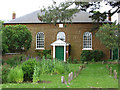
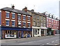
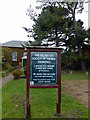
Photos of Wellingborough

Area Information
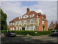
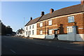
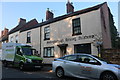
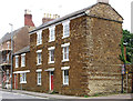
Wellingborough, a built-up area of 14.3 km² in Northamptonshire, is home to 12,109 residents, giving it a population density of 845 people per square kilometre. This compact town blends suburban comfort with practical urban living, offering a mix of housing types and a well-established local infrastructure. The median age of 70 suggests a community skewed towards older adults, though the area remains accessible to families with its network of primary and nursery schools. Residents benefit from proximity to Wellingborough Railway Station, which connects to nearby towns, and a range of retail options, including Morrisons and Budgens. The broadband score of 99 ensures reliable internet access, supporting both remote work and daily connectivity. While the area’s character is defined by its quieter, more mature demographic, its practical amenities and transport links make it a viable choice for those seeking a stable, low-maintenance lifestyle.
- Area Type
- Built Up Area 250
- Area Size
- 14.3 km²
- Population
- 12109
- Population Density
- 845 people/km²
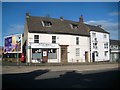
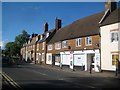
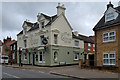
Wellingborough’s amenities include retail hubs like Morrisons Wellingborough and Heron Wellingborough, providing everyday shopping convenience. The railway station is a key transport link, facilitating travel to surrounding areas. While the data does not mention parks or leisure facilities, the presence of multiple schools and retail options suggests a community focused on practical living. The compact layout of the town ensures amenities are within easy reach, supporting a lifestyle that prioritises accessibility over expansive recreational spaces.
Amenities
Schools
Wellingborough’s educational landscape includes Croyland Nursery School & Day Nursery, Highfield Nursery School, Croyland Infant School, Croyland Junior School, and Park Junior School. These institutions cater to early years education and primary schooling, providing a range of options for families with young children. The presence of both infant and junior schools suggests a structured approach to education, though no Ofsted ratings are provided in the data. For parents, the availability of multiple schools within the area reduces the need for long commutes, supporting a family-friendly environment.
| Rank | School | Type | Entry gender | Ages |
|---|
Explore more schools in this area
Go to Schools tabDemographics
Wellingborough’s population is predominantly older, with a median age of 70, indicating a community where retirees and long-term residents form the majority. Home ownership rates stand at 60%, reflecting a balance between owner-occupied properties and rental housing. The data does not specify household composition or ethnic diversity, but the 845 people per km² density suggests a compact, closely knit population. This age profile may influence local services, with a focus on healthcare and leisure facilities tailored to older adults. While the area lacks detailed breakdowns of household types or cultural diversity, the stable home ownership rate implies a degree of long-term residency and community continuity.
Household Size
Accommodation Type
Tenure
Ethnic Group
Religion
Household Composition
Age
Household Deprivation
NS-SEC
Explore more demographic insights in this area
Go to Demographics tabPlanning
Planning Constraints
- Crime RiskPremium