Area Overview for Wardlow
Photos of Wardlow

Area Information
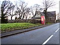
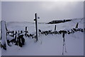
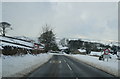
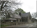
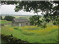
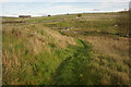
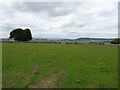
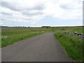
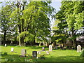
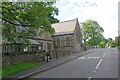
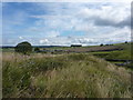
Wardlow is a small civil parish situated in England, covering an area of 2.6 km². This compact geography means distances are short, and the community feels close-knit. Living in Wardlow offers a quiet environment where the natural landscape dominates the immediate surroundings. The parish is defined by its green spaces, including protected nature reserves and patches of protected woodland. These designations shape the character of the area, balancing residential living with environmental conservation. You will find that Wardlow is not a sprawling urban district but a focused settlement where local life revolves around these natural features. The small size of the parish means that roads are local and the pace is generally slower than in larger towns. This setting is ideal for those who value tranquillity over city centre convenience. The layout supports a lifestyle where you can step outside and encounter trees and wildlife within minutes of your home. Daily life here is structured around the immediate parish boundaries rather than sprawling commuter networks. You live in a space where the history of each plot is likely intertwined with the land itself.
- Area Type
- Parish
- Area Size
- 2.6 km²
- Population
- Not available
- Population Density
- Not available
Demographics
The community in Wardlow reflects a demographic profile heavily weighted towards older residents. The median age stands at 70 years, which defines the social rhythm of this parish. Most households likely consist of older adults or individuals living alone. Seventy-seven per cent of homes in Wardlow are owner-occupied, indicating a settled population with deep roots in the area. This high rate of ownership suggests that many families have stayed in Wardlow for decades, raising children and retiring here over a lifetime. The household composition data shows a total snapshot of this stable society, with very few transient residents compared to bustling city districts. There is no data provided on specific ethnic groups, religious breakdowns, or specific deprivation indices for this parish. Consequently, the demographic picture remains clear on age and ownership without extended speculation on other social factors. This absence of data should not be read as a lack of research, but simply as an unknown variable for this specific location. For you as a buyer, the age profile informs who your neighbours will be and what community services might dominate local priorities. You are entering a community where the average homeowner is significantly older than the national average.
Household Size
Accommodation Type
Tenure
Ethnic Group
Religion
Household Composition
Age
Household Deprivation
NS-SEC
Explore more demographic insights in this area
Go to Demographics tabPlanning
Planning Constraints
- Flood RiskPremium
- Ramsar Wetland SitesPremium
- Area of Outstanding Natural BeautyPremium
- Protected Nature ReservePremium
- Protected WoodlandPremium
- Crime RiskPremium