Area Overview for Wanlip
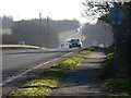
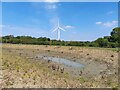
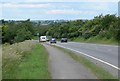
Photos of Wanlip


Area Information
Wanlip is a compact built-up area spanning 37.8 hectares, situated in England. It is home to a population predominantly in the 70-year age bracket, shaping a community with a distinct demographic profile. Living here means navigating a town characterised by a mix of residential and retail spaces. The area’s proximity to retail hubs such as Waitrose Little and Costco Leicester, alongside accessible rail networks including Syston and Sileby stations, ensures daily life is convenient for residents. With a broadband score of 97, digital connectivity is near-excellent, supporting both remote work and leisure. Wanlip’s compact size means amenities are within practical reach, though its older demographic suggests a quieter, more settled atmosphere. For those considering a home here, the balance of local services, transport links, and digital infrastructure offers a functional, if unflashy, lifestyle. The 66% home ownership rate indicates a stable housing market, though the area’s character is defined more by its practicality than grandeur.
- Area Type
- Built Up Area 250
- Area Size
- 37.8 hectares
- Population
- Not available
- Population Density
- Not available
Wanlip’s residents have access to a range of nearby amenities, including retail outlets such as Waitrose Little, Co-op Rothley, and Costco Leicester, which provide essential shopping options. The area’s rail network includes Syston, Sileby, and Barrow upon Soar stations, offering convenient links to other parts of the region. Metro services like Rothley and Great Central Railway stations further expand connectivity, supporting both daily commutes and leisure travel. While specific details about parks or leisure facilities are not provided, the presence of multiple retail and transport hubs suggests a practical, service-oriented lifestyle. The proximity to major retailers and transport nodes means residents can meet daily needs without long journeys. The area’s compact size ensures that amenities are within walking or short driving distance, contributing to a convenient, if modest, quality of life. The mix of retail and transport options underscores Wanlip’s role as a functional, accessible community.
Amenities
Schools
| Rank | School | Type | Entry gender | Ages |
|---|
Explore more schools in this area
Go to Schools tabDemographics
Wanlip’s population has a median age of 70, reflecting a community skewed towards older residents. The most common age range encompasses the total population, suggesting a lack of younger demographics. Home ownership stands at 66%, indicating a majority of residents live in their own homes rather than renting. Accommodation types and household compositions are not specified in the data, but the overall figures imply a settled, possibly family-oriented population. Ethnic and religious diversity statistics are not provided, so no conclusions can be drawn about cultural composition. The absence of detailed deprivation data means quality of life factors such as access to services or income levels remain unexplored. However, the broadband score of 97 suggests minimal barriers to digital connectivity, which is a key component of modern living. The area’s demographic profile is clear: a mature, stable community with a focus on residential stability over transient populations.
Household Size
Accommodation Type
Tenure
Ethnic Group
Religion
Household Composition
Age
Household Deprivation
NS-SEC
Explore more demographic insights in this area
Go to Demographics tabPlanning
Planning Constraints
- Crime RiskPremium